CA
Joshua Tree National Park
The desert park where Minerva Hoyt's forty-year lobbying campaign won out. The Mojave and Colorado deserts meet on a single loop road.
Established
Our episode: Joshua Tree National Park | How does anything survive in a desert this dry?
We spent three days at Joshua Tree in mid-November with the kids. Seventy degrees in the afternoon, thirty-eight at night, weekday trailheads nearly empty. The structured stuff below is what we wished we’d known before we drove in; the closing line is the one we say out loud when we leave any park.
Three days in November with two kids was exactly right. Mid-week if you can. Bring more water than you think. Keep the tweezers in the glove box.
Now go outside and touch grass.
I
Basic info
- Established
- 1994
- Area
- 792,510 acres
- Visitors (2024)
- 2,991,874
- Elevation
- 536–5,814 ft
- Designation
- National Monument (1936)
- Designation
- National Park (1994)
II
Logistics
Before you go
- Getting there
- Joshua Tree is about 140 miles east of Los Angeles, off I-10 or California Highway 62. The West Entrance is five miles south of Highway 62 at Joshua Tree village, and the closest airport is in Palm Springs. NPS
- How many days
- NPS times the drives between entrances without stops, though it offers no day-by-day plan. The West Entrance to the North Entrance takes about 45 minutes, and the West Entrance to the South Entrance at Cottonwood about 1 hour 30 minutes. NPS Build a day-by-day plan
- Entrance fee
- Entry costs $30 per private vehicle for 7 days (2026). An America the Beautiful pass covers entry. NPS
- Pets
- Leashed pets may stay within 100 feet of roads, picnic areas, and campgrounds (2026). Trails, the backcountry, and park buildings are closed to pets, and the park posts B.A.R.K. Ranger rules but no longer sells the tags. NPS
Seasons
Spring
- Peak season. March–April crowds; trailhead parking fills by 9 a.m. on weekends.
- Wildflowers late February through early April. Highs already in the 80s by mid-March.
- The wildflower window. Get on a trail by 7 a.m. or accept the parade.
Summer
- Ranger programs scale back. Visitation drops sharply.
- Highs routinely 100°F+; thunderstorms in late July and August.
- Stargazing season. The Dark Sky Park designation is its own reason to come, even with the heat.
Fall
- Second high season. October and November are the comfortable months we went with the kids.
- 70°F afternoons, 38°F nights in November. Layer everything.
- Quieter than spring; ranger programs still running; the cottonwoods in the wash are gold.
Winter
- Highs in the 50s and 60s; freezing nights at elevation; occasional snow above 4,500 ft.
- Cold but clear. Weekdays are nearly empty.
- Climbing season for serious climbers — the rock is at perfect friction temperature.
Joshua Tree National Park with kids
Joshua Tree is the desert park we recommend for first-time desert families. The headline trails are short, the rock formations invite scrambling, and the kids can see the geology at eye level. The heat is real — pack twice the water you think you need.
- Junior Ranger booklet at any visitor center (Oasis, Joshua Tree, Cottonwood, Black Rock). Big and Little both finished theirs in the first afternoon.
- Cholla spines do not negotiate with pliers. Pack precision tweezers and keep them in the glove box. Big learned this the hard way.
- Cell signal is essentially nil. Download maps and podcasts before you drive in.
- Layer for 30°F swings between afternoon and night. Same parking lot, completely different temperature.
- Stay one night for the stars — Joshua Tree is an International Dark Sky Park. We let the kids stay up an extra hour and they still talk about it.
Accessibility
Several of the park's headline stops have paved or near-paved access. Keys View is a paved overlook from the parking lot. Cholla Cactus Garden is a flat 0.25 mi loop with packed surface — wheelchair-rated "with assistance." Most other named trails are short but unimproved.
- Keys View — paved overlook from the parking lot; no trail required for the headline photograph.
- Cholla Cactus Garden — flat 0.25 mi loop; packed surface; wheelchair-rated with assistance.
- Oasis Visitor Center — fully accessible; the best place to start if anyone in the party uses mobility aids.
- Most named trails (Hidden Valley, Barker Dam) are unimproved sand and rock — not wheelchair-rated. Strollers handle Cholla but struggle elsewhere.
Things you can't miss
Natural places
Hidden Valley↗
A one-mile loop walled in by monzogranite, flat enough that Little walked it without complaint and dense enough with climbing routes that the climbers outnumbered the hikers by mid-morning. The trailhead is at Hidden Valley Picnic Area off Park Boulevard; the cattle-rustler hideout the rangers field questions about is rumor only.
Cholla Cactus Garden↗
A quarter-mile loop through a dense stand of Cylindropuntia bigelovii, the teddy-bear cholla, where the higher Mojave meets the lower Colorado desert and the species mix you came for is mostly the species mix at this one stop. The detached joints jump onto pant legs on contact — Big learned this. The sign at the trailhead is not a joke; bring precision tweezers.
Arch Rock↗
A 1.4-mile loop from the Twin Tanks parking area to a wind-and-water-eroded arch in the White Tank monzogranite, around 85 million years old per the USGS Joshua Tree geology page. The arch sits along a north-south joint and the spur traffic is light enough that Little had the rock to herself for ten minutes at golden hour.
Skull Rock↗
A granite formation along Park Boulevard east of Jumbo Rocks Campground, eroded by rainwater into two deep hollows that read as eye sockets from the pullout across the road. The full nature-trail loop runs 1.8 miles with about 120 ft of elevation change over dirt and rock; the formation itself is a 30-second walk from the parking pullout, with the loop optional.
Cottonwood Spring↗
A spring-fed palm oasis seven miles inside the south entrance, and the only place inside the park where the NPS attaches a specific Indigenous nation to the site: per the Cottonwood Spring page, the spring "was used for centuries by the Cahuilla Indians, who left bedrock mortars and clay pots, or ollas, in the area." The bedrock mortars are in the rock just past the oasis. The fan palms here first appeared around 1920 per NPS, which makes them younger than the spring and younger than the people who used it.
Wonderland of Rocks↗
The dense monzogranite expanse between Hidden Valley and Indian Cove — what the NPS Willow Hole hike page calls "a labyrinth of cliffs, canyons, domes, and unique rock formations" — entered on foot from Barker Dam or Willow Hole, never by car. The monzogranite is more than 100 million years old per NPS and was exposed by groundwater weathering of joint fractures. Day-use only; the interior closes sunset to sunrise to protect bighorn-sheep habitat.
Black Rock Canyon↗
The 4,000 ft northwestern corner of the park, where Joshua trees, junipers, and pinyon pines grow on the same slope — a high-desert transition the central Park Boulevard interior never shows. Reached from its own entrance off Highway 62 at Yucca Valley, not connected by road to the park interior. The Nature Center sits at the trailhead for the Panorama Loop, where the vegetation hand-off is visible from the trail.
Ocotillo Patch↗
A pullout on Pinto Basin Road where runoff from two ranges feeds an alluvial-fan stand of Fouquieria splendens, dense enough that NPS named the pullout for them. Ocotillo leaf out within days of a rain and shed the leaves between rains per the NPS ocotillo ecology page — visible behavior across a multi-day visit if it rains. Paired with the Cholla Cactus Garden up-road, this is the Mojave-to-Colorado-desert ecotone in one drive.
Indian Cove↗
The Wonderland-of-Rocks northern lobe, reached only from Indian Cove Road off Highway 62 between the West and North Entrances — its own gate, not connected by road to Park Boulevard. Same monzogranite playground as Hidden Valley, less central-park traffic, and the only way to see the Wonderland from its northern side. The name is a 20th-century park-administrative artifact; the four nations traditionally associated with the park (Serrano, Cahuilla, Chemehuevi, Mohave) hold at the park-wide level, with no NPS-published Indigenous endonym for the site.
Lost Palms Oasis↗
A fan-palm oasis at the end of a 7.5-mile out-and-back from the Cottonwood Spring trailhead with about 500 ft of elevation gain. NPS describes the trail as having "very little shade" and not recommended in summer or anytime it is hot. Older-kid territory — the Mastodon Peak loop from the same trailhead is half the distance for a younger kid.
Nearby attractions
Noah Purifoy Outdoor Desert Art Museum↗
Ten acres of large-scale assemblage Noah Purifoy built between 1989 and his death in 2004 — toilets, vacuum cleaners, plywood, and bowling balls left to weather in the high desert. Free, dawn to dusk. Purifoy was a founding director of the Watts Towers Arts Center in the Sixties, and the desert work, made after he moved to the Mojave in 1989, is the second act.
Pioneertown↗
Dick Curtis, Roy Rogers, and Russell Hayden built Pioneertown in 1946 as a live-in Old West movie set; people moved into the cabins between shoots and never left. Mane Street is still the main strip, Pioneer Bowl still has six lanes, and the cantina that became Pappy & Harriet's anchors the south end.
Places to stay
Jumbo Rocks Campground↗
124 sites tucked between the same monzogranite formations that make Skull Rock the photograph every visitor takes home. Vault toilets, no water on site, no hookups; book six months out the day reservations open if you want a spring weekend. The evening ranger amphitheater pulls in everyone within walking distance.
29 Palms Inn↗
Adobe bungalows and wood-frame cottages on the Oasis of Mara, established as the 29 Palms Inn in 1928. The Oasis was settled first by the Serrano, joined in 1867 by the Chemehuevi; the federally recognized Twentynine Palms Band of Mission Indians descends from the Chemehuevi lineage there. Family-run, on-site restaurant and pool, and the NPS Oasis Visitor Center is a short walk through the palms.
Viewpoints and camping
Keys View↗
5,185 ft at the end of Keys View Road, paved from the parking lot, about 5.5 miles off Park Boulevard. On a clear morning the sight lines reach the Salton Sea, the San Andreas Fault trace along the base of the San Jacintos, and — rarely now — Signal Mountain in Baja California, 90 miles south. By afternoon the Coachella Valley inversion usually swallows the south half of the view — go early.
Cap Rock at sunset↗
A 0.4-mile loop at the junction of Park Boulevard and Keys View Road, no permit required beyond entry. The granite cap balanced on the larger boulder lights up the way the photographs say it does for about twenty minutes after the sun drops behind the San Bernardinos. The boulder that gives Cap Rock its name is a textbook example of the spheroidal weathering visible across the central park.
Trails worth the time
Barker Dam Loop↗
A 1.1-mile loop past a stock dam the Barker & Shay Cattle Company laid down in 1900 to water their herd. Holds water in wet winters, dry most of the year. A short spur off the main loop reaches a rock-art panel attributed to ancestors of the Serrano, Cahuilla, Chemehuevi, and Mojave peoples; a 1960 film crew working on a Disney TV episode painted over the original pigments, and the damage is permanent.
Ryan Mountain↗
Three miles out-and-back, about 1,069 ft up to a 5,457-ft summit with a full 360 across the central park: Queen Valley below, the Wonderland of Rocks north, Lost Horse Valley west. No shade, no water; start by 8 a.m. in spring or the last mile becomes a problem.
Lost Horse Mine↗
Four miles out-and-back to one of the best-preserved stamp mills in any National Park Service unit. Johnny Lang and his father staked the claim around 1890 after buying out a prospector called Dutch Frank; J.D. Ryan, a Montana rancher, bought in by 1895 and replaced the two-stamp setup with the ten-stamp mill that still stands. The mine ran until 1931 and became part of Joshua Tree National Monument in 1936.
Food and drink
Pappy & Harriet's Pioneertown Palace↗
Tex-Mex and mesquite-grilled barbecue in a building that began life in 1946 as a cantina on the Pioneertown movie set. Harriet and Claude "Pappy" Allen opened it as Pappy & Harriet's in 1982; new owners reopened it as a touring music venue in 2003, and the surprise-show file now includes Robert Plant, Paul McCartney, and Vampire Weekend. Kid-friendly until 9 p.m., reservations strongly recommended.
29 Palms Inn restaurant↗
Garden-to-table cooking out of the inn's own two-acre Faultline Farm — produce harvested by the chef and on the menu the same day — served on a flagstone patio under the same oasis palms. The closest sit-down kitchen to the NPS Oasis Visitor Center. Walk-ins are welcome subject to seating but the patio fills up on spring weekend nights, so call ahead.
Our pick for things to do nearby
Joshua Tree Night Sky Festival↗
An annual October gathering of rangers, visiting astronomers, and most of the telescopes in San Bernardino County, hosted out of Sky's the Limit Observatory & Nature Center in Twentynine Palms and rotating into the park amphitheaters. Joshua Tree was designated an International Dark Sky Park in 2017, and the Bortle 2 sky over the interior delivers a naked-eye Milky Way most months. The festival is a ticketed event with limited capacity; tickets go on sale in early summer.
Common questions
- When should we go with kids?
- Mid-October through mid-April. Mid-November was 70°F afternoons and 38°F nights with empty weekday trailheads. Avoid May–September — daytime temperatures routinely clear 100°F.
- How long should we plan to stay?
- One day for the highlights (Barker Dam, Hidden Valley, Cholla Garden, Keys View at sunset). Two to three days lets you slow down. Three days still left us wanting more.
- Is there cell service in the park?
- Essentially none. Download the NPS app offline maps before you drive in. Download podcasts too — the loop road is slow and the kids will ask.
- Where do we get water and gas?
- No water inside the park interior. Fill up at the West Entrance, the Oasis Visitor Center, or Cottonwood. No gas in the park — fill up in Yucca Valley or Twentynine Palms.
- What is the entrance fee?
- $30 per vehicle for a 7-day pass. If you are hitting two more national parks in the next twelve months, the America the Beautiful Annual Pass at $80 pays for itself by the third unit.
- Do we need timed-entry reservations?
- No timed-entry system as of 2025. Camping at all eight campgrounds is either reservable or first-come on recreation.gov; reserve months ahead for spring.
- Why is it called Joshua Tree National Park?
- The park is named for the Joshua tree. A legend says Mormon pioneers thought its limbs looked like the raised arms of Joshua leading them to the promised land. The NPS says no record backs the story up.
- Do we need a reservation to visit Joshua Tree National Park?
- No. Entry needs no advance reservation (2026). Most campgrounds require reservations on Recreation.gov, and so does the ranger-led Keys Ranch tour. Other ranger programs are free and walk-up.
Wild things at Joshua Tree National Park
See all 15 →-
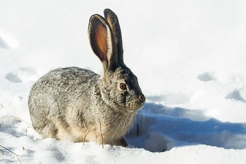 Mammal
 Black-tailed jackrabbit
Lepus californicus
A big-eared hare of Joshua Tree and Lava Beds that dumps body heat through its ears and outruns coyotes in zigzags at 40 miles an hour.
-
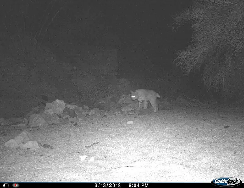 Mammal
 Bobcat
Lynx rufus
A small wildcat about twice the size of a house cat, common but rarely seen, that can bring down prey many times its own weight.
-
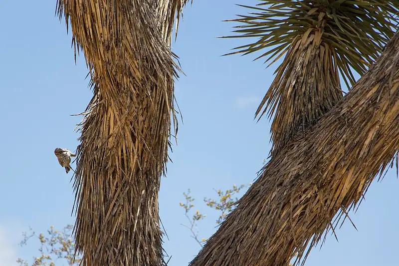 Bird
Bird Cactus wren
Campylorhynchus brunneicapillus
The largest wren in the U.S., which jams a football-shaped nest deep inside a cholla cactus's own thorns for protection.
-
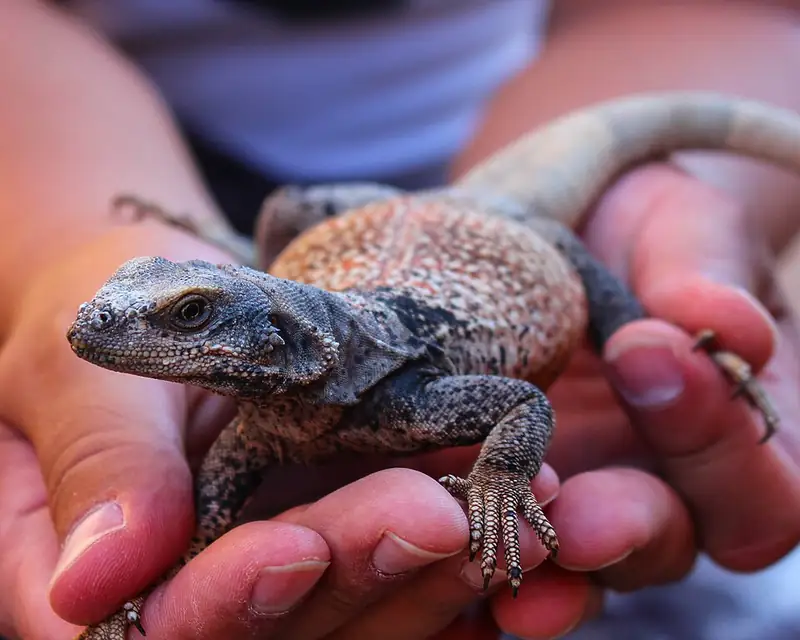 Reptile
 Common chuckwalla
Sauromalus ater
Joshua Tree's largest lizard, a slow plant-eater that wedges into a rock crack and inflates its lungs so nothing can pull it back out.
-
 Bird
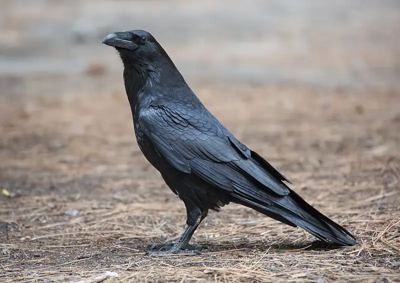
Bird Common raven
Corvus corax
A big, glossy-black problem-solver that rolls and tumbles over the cliffs of Grand Canyon, Arches, and the desert parks, watching for its next meal.
-
 Mammal
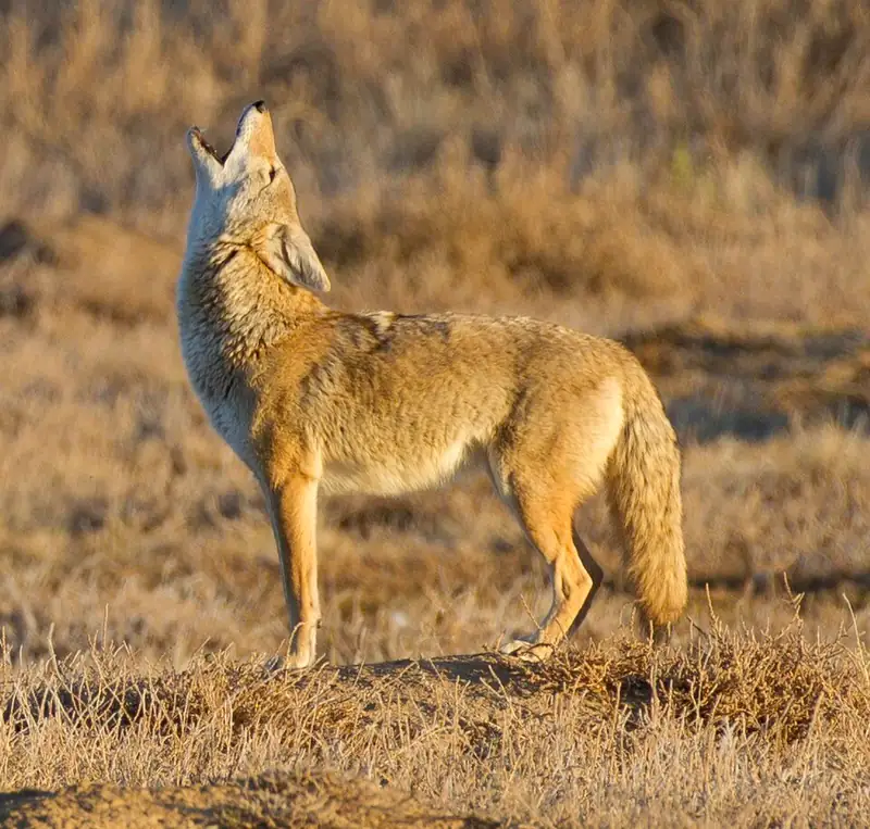
 Coyote
Canis latrans
The wild dog you're most likely to hear at a national park — a coyote, at home in the desert, the mountains, and the edges of towns.
III
History
Who shaped this place
Indigenous nations
- Maara'yam (Serrano) — The Maara'yam (Serrano) homeland includes the land Joshua Tree National Park manages, and NPS describes the Serrano as one of the four desert peoples who settled around the springs of this country and knew it in depth.
- Kawiya (Cahuilla) — The Kawiya (Cahuilla) homeland includes the land Joshua Tree National Park manages. NPS names the Kawiya alongside the Maara'yam and the Nüwü as the peoples whose traditional homelands it holds.
- Nüwü (Chemehuevi) — The Nüwü (Chemehuevi) homeland is one of the three Joshua Tree National Park names, alongside the Maara'yam and the Kawiya.
- Aha Macave (Mohave) — The Aha Macave (Mohave) hold the park as a traditional use area rather than a homeland, and NPS records the desert peoples' long ties to the people on the Colorado River and the Pacific Coast. Artifacts found at archeological sites in the park came from hundreds of miles away.
- Agua Caliente Band of Cahuilla Indians — Joshua Tree National Park is one of the places the Agua Caliente Band of Cahuilla Indians tells its migration story, and the park's visitor center shows a film of the band's account.
- Augustine Band of Cahuilla Indians — Congress set aside the Augustine Reservation on December 29, 1891, and the band's own history says the Cahuilla were the first known inhabitants of the Coachella Valley more than 3,000 years ago. The band descends from Captain Vee-Vee Augustine, born in 1820.
- Cahuilla Band of Indians — The Cahuilla Band of Indians says it is Mountain Cahuilla, Qawishpa Cahuillangnah, one of the original peoples of Southern California. Its government is in Anza, California.
- Chemehuevi Indian Tribe — The Chemehuevi Indian Tribe's own site lists a cultural center, a conservation department, a water department, and a clinic among the departments it runs.
- Colorado River Indian Tribes — The Colorado River Indian Tribes are four tribes in one government, the Mojave, Chemehuevi, Hopi, and Navajo, and the reservation covers almost 300,000 acres along both banks of the Colorado River. Its main community is Parker, Arizona.
- Fort Mojave Indian Tribe — The Fort Mojave Indian Tribe calls its people the Pipa Aha Macav, the people by the river, and says their trade networks once reached the Pacific Ocean. Their reservation runs nearly 42,000 acres along the Colorado River.
- Morongo Band of Mission Indians — The Morongo Band's own history says its name is believed to come from the Serrano word Marringa and says the Serrano who came down from the north joined the Cahuilla already living in the San Gorgonio Pass. The band sits in traditional Cahuilla territory at the foot of the San Gorgonio Mountains.
- Ramona Band of Cahuilla — The Ramona Band of Cahuilla says Cahuilla people have lived in the Anza Valley for more than two thousand years and that the band's members descend from the Apapatchem Clan. The reservation was established in 1893.
- Yuhaaviatam of San Manuel Nation — The Yuhaaviatam of San Manuel Nation say they are the Yuhaaviatam Clan of Maara'yam, the Serrano people, and the people of the pines.
- Santa Rosa Band of Cahuilla Indians — The Santa Rosa Band of Cahuilla Indians says its members descend from three Cahuilla clans that held Toro Peak, Coyote Canyon, the Garner Valley, and the land of the present reservation. Those clans spent the winter in the lower desert canyons and moved up to Toro Peak and the pines in the heat of summer.
- Soboba Band of Luiseño Indians — The Soboba Band of Luiseño Indians says its people have inhabited the land around San Jacinto, Hemet, and Valle Vista since time immemorial, and the reservation lies at the base of the San Jacinto Mountains. The band's members descend from both Cahuilla and Luiseño ancestry.
- Torres Martinez Desert Cahuilla Indians — The Torres Martinez Desert Cahuilla say the Cahuilla have lived in Martinez Canyon since the early 1800s, and an executive order by President Ulysses S. Grant created the Torres and Martinez reservations in May 1876. The two were joined under the Relief of Mission Indians Act of 1891.
- Twenty-Nine Palms Band of Mission Indians — The Twenty-Nine Palms Band of Mission Indians is descended from the Chemehuevi, whose territory once covered parts of California, Utah, Arizona, and southern Nevada. Its 1895 reservation was established at Twentynine Palms, and the tribe says it has a strong relationship with the desert country that includes Joshua Tree National Park.
Advocates
- Minerva Hamilton Hoyt↗ — Conservationist (1866–1945)
The South Pasadena gardener called the "Apostle of the Cacti." Founded the International Deserts Conservation League in 1930, mounted desert-flora exhibits in New York, London, and Boston, hired the biologists who surveyed the desert, and personally lobbied FDR. Without her, no monument.
- Edmund C. Jaeger — Desert ecologist
Author of The California Deserts (1933), the foundational scientific text Hoyt used to defend monument boundaries. Surveyed the area on foot for years.
- Senator Dianne Feinstein — U.S. Senate, California (1933–2023)
Sponsored the 1994 California Desert Protection Act that upgraded Joshua Tree to national park status and added back roughly 234,000 acres lost in the 1950 boundary cut.
- The Wildlands Conservancy↗ — Private land trust
Donated roughly 600,000 acres bordering Joshua Tree and Mojave in 1999 — the largest private land gift to the federal government in U.S. history.
Detractors
- Mining and mineral interests — 1936 boundaries through 1950 reduction
Fought the original 1936 monument boundaries and won a 265,000-acre reduction in 1950 (Proclamation 2892 under Truman) that released mining lands. The 1994 upgrade restored most of it.
- Cattlemen and homesteaders — Early 20th century
Section 4(j) of the 1994 Act preserved some grazing rights. The Hidden Valley loop, today a kid-friendly hike, was a 19th-century cattle-rustler hideout — the boulder walls made enclosed pasture cheap.
Timeline
Joshua Tree National Monument proclaimed
President Franklin D. Roosevelt signed Presidential Proclamation 2193 on August 10, 1936, creating the monument at roughly 825,000 acres after a decade of lobbying by Minerva Hoyt.
265,000-acre boundary cut
Proclamation 2892 under Truman released mining lands and reduced the monument by roughly a third — a major loss for desert conservation at the time.
Wilderness designation
Congress applied the 1964 Wilderness Act to 429,690 acres of the monument, restricting roads, mechanized travel, and most development.
Upgraded to national park
On October 31, 1994 President Clinton signed the California Desert Protection Act (P.L. 103-433), upgrading Joshua Tree to national park status and adding back roughly 234,000 acres for a total of 792,510 acres.
Surrounding monuments added
President Obama designated Sand to Snow National Monument and Mojave Trails National Monument adjacent to Joshua Tree, roughly doubling the protected desert in the region.
International Dark Sky Park
DarkSky International certifies Joshua Tree as one of the largest urban-adjacent dark sky parks in the lower 48 — the kids' first Milky Way is going to be here.
Dingell Conservation Act
P.L. 116-9 added small boundary parcels and codified the 1994 wilderness designations against future challenge.
2,991,874 visitors
Roughly double the 2014 visitation. Spring (Mar–Apr) is the crowd peak; fall (Oct–Nov) is the quieter second peak we hit with the kids.