UT
Capitol Reef National Park
A 100-mile wrinkle in the Utah desert, with a pioneer orchard at its heart and 1,000-year-old rock art along the highway.
Established
The rain had stopped by the time we drove in. The park had not. The ground was mud from the gate to the campground, and a barricade still sat across part of the Scenic Drive where the road had come apart and nobody had put it back yet. We parked in the orchards and walked into the visitor center to ask what was open.
Capitol Reef is a 100-mile wrinkle of rock in the Utah desert, the Waterpocket Fold, and the flat bottom of it holds something a desert shouldn’t: an orchard. Fruita was a pioneer settlement from 1880 into the 1960s, and the trees it left behind still stand — roughly 1,900 of them, watered by hand-dug ditches, per the NPS. The historic core fits in a walk: a one-room schoolhouse the residents built in 1896, a blacksmith shop, and the 1908 Gifford Homestead, whose store sells baked goods from mid-March through the end of October. The petroglyph panel along UT-24 sits behind a paved boardwalk — bighorn sheep, trapezoid-bodied people, handprints cut between roughly 300 and 1300 CE. Hickman Bridge is the short walk in the core, 1.8 miles round trip to a 133-foot natural bridge over the Fremont River.
The land is the homeland of the ancestral Fremont Culture, whose descendants Hopi and Zuni oral traditions keep, and later of the Ute, Southern Paiute, and Diné peoples; the NPS records thirty-two tribes with an ongoing association with the place.
Two things shape a visit. The first is water and supplies. There is no gas in the park and no cell service past the visitor center, so the tank gets filled in Torrey, 11 miles west, before you turn in. The second is weather. Grand Wash and Capitol Gorge run through narrow canyons that flood, and from mid-July to early September the NPS posts a daily flash-flood forecast at the visitor center. The Scenic Drive and both of its dirt spurs can also close for snow, ice, mud, and flash floods, which is why we did most of our looking from the van.
From our visit
- The campground inside the orchards. Fruita Campground is the park’s only one: 71 sites in a ring of fruit trees along the Fremont River, cliffs on both sides. We woke one morning to a dozen mule deer feeding between the van and the next site, close enough to hear them pulling at the grass.
- Apples you could eat where you stood. The orchards are U-Pick when they’re signed open, and the sign points to a scale, a price list, and a self-pay station at the entrance. Big filled a bag for the van. Little picked one at a time and ate them where she stood. We bought a pie at the Gifford Homestead every day we were there.
- Two afternoons at Sulphur Creek. The creek runs shallow over the rock a few steps behind the visitor center. Big spent the first afternoon damming it with flat stones. Little spent the second walking upstream to find where the water came from and reporting back that it came from “over there.” Nobody wanted to leave either time.
- Touring from the van. With the trails mud, we drove the open stretch of the Scenic Drive and stopped where the view was: the Waterpocket Fold laid out in cross-section, red on white on gray.
- The ranger walk, then the old buildings. A ranger walked us along the petroglyph panels and read the figures out loud, which is not the same as reading a sign. Afterward we went through the schoolhouse and the blacksmith shop.
- Two evening programs. The first night a ranger talked about bison — native to this country, with the nearest herd now over in the Henry Mountains, managed by the state. The second night we sat in the campground amphitheater and learned the constellations.
- Erika’s verdict. “This is my favorite park,” she said on the way out, and then spent the next hour defending it: the deer, the apples, the pie, the creek. It was the park with the closed road and the mud.
We packed up on the morning of the thirtieth and drove to Bryce.
I
Basic info
- Established
- 1971
- Area
- 241,904 acres
- Visitors (2024)
- 1,400,000
- Elevation
- 3,877–8,960 ft
- Designation
- National Monument (1937)
- Designation
- National Park (1971)
II
Logistics
Before you go
- Getting there
- The visitor center sits in the middle of the park on Utah Highway 24. From I-70, take Exit 149 and follow SR-24 west through Hanksville, and do not rely on GPS alone. NPS
- How many days
- One or two hours covers the visitor center, the Hickman Bridge hike, and the Scenic Drive (about 90 minutes round trip). A full day adds a longer hike such as Cohab Canyon or Chimney Rock, or a drive into Cathedral Valley. That drive often needs high clearance and four-wheel drive. NPS
- Entrance fee
- Entry costs $20 per private vehicle (2026), and NPS does not say how many days it lasts. An America the Beautiful pass covers entry. NPS
- Pets
- Leashed pets (6 feet or shorter) may use campgrounds, picnic areas, unlocked orchards, the trail from the visitor center to the campground, the Fremont River Trail to Hattie's Field, and land within 50 feet of roads (2026). Other trails, buildings, and the backcountry are closed to pets, and the park promotes the B.A.R.K. Ranger rules. NPS
Seasons
Spring
- The best family window. Orchard blossoms come on in late March and early April; the Scenic Drive and the UT-24 trails are open and uncrowded compared with summer.
- 60s to 80s °F. Cool nights. Fruit-tree blossoms in the Fruita orchards.
- Walk Hickman Bridge and the Fruita historic district before the summer heat and crowds. Cherries ripen in the orchards by early June.
Summer
- Peak visitation and peak heat. June and July are the busiest months. Monsoon storms arrive in July and run into September, and flash floods can fill Grand Wash and Capitol Gorge in minutes.
- 90s °F. Afternoon thunderstorms July to September.
- Hike before 10 a.m. Check the daily flash-flood forecast at the visitor center before entering any narrow canyon. Pick apricots in late June, peaches in August.
Fall
- The second family window. Apple harvest runs through the orchards and the cottonwoods along the Fremont River yellow in late October.
- 70s to 80s °F days, cool nights. Cottonwoods turn gold late October.
- Pick apples September into October, walk the Scenic Drive, and catch the Castle and the cliffs in low afternoon light.
Winter
- The quiet season. UT-24 and the Scenic Drive are plowed and stay open; the Capitol Gorge and Grand Wash spurs and the high-country roads can close with snow.
- 30s to 50s °F days, 10s to 20s °F nights. Snow on the Castle and the white domes.
- Short daylight and cold mornings buy you near-empty trails and snow on red rock. Cathedral Valley is generally out until spring.
Capitol Reef National Park with kids
Capitol Reef splits into a family-walkable core and a backcountry that a sedan cannot reach. The core is the Fruita historic district (orchards, pie at the Gifford Homestead, the schoolhouse, the petroglyph boardwalk), the free UT-24 corridor, and the paved 8-mile Scenic Drive. That core holds the best kid stops in the park. The Cathedral Valley and Waterpocket Fold districts need a high-clearance 4WD or a backpack, so a family-with-kids itinerary plans around the core and treats the far districts as a separate, later trip. There is no gas in the park and no cell service past the visitor center.
- The Capitol Reef Junior Ranger booklet is free at the visitor center and is one of the better ones in the Utah parks.
- Hickman Bridge (1.8 mi round-trip, about 400 ft of gain) is the best short destination hike, ending under a 133-foot natural bridge.
- The Fremont petroglyph boardwalk on UT-24 is paved, level, and stroller-friendly; bring binoculars, the figures sit high on the cliff.
- The Gifford Homestead store is seasonal — NPS lists it from mid-March to the end of October — and it is the only food sold inside the park. In season the pies go fast, so buy one when you pass, not when you are hungry at four.
- Check the daily flash-flood forecast at the visitor center before walking Grand Wash or Capitol Gorge from mid-July to early September.
Accessibility
Several headline stops sit at or near the car along the free UT-24 corridor and the paved Scenic Drive. The Fremont petroglyph boardwalk is paved and level. Goosenecks Overlook is a tenth of a mile from the spur-road parking. The deeper districts (Cathedral Valley, Strike Valley Overlook) are high-clearance 4WD only and are not accessible to a sedan or to wheels.
- Fremont petroglyph boardwalk on UT-24: paved, level, and stroller-friendly, a few steps from the pullout.
- Goosenecks Overlook: a 0.1-mile walk to the rim from the spur-road parking off UT-24, with the canyon roughly 800 feet below.
- The 8-mile Scenic Drive is paved with level pullouts; the Capitol Gorge and Grand Wash gravel spurs are usually fine for any car in dry weather.
- The Scenic Drive and its two dirt spurs, Grand Wash and Capitol Gorge, close when snow, ice, mud, or flash floods make them impassable. Rangers post the current road status at the visitor center.
- Strike Valley Overlook and the Cathedral Valley temples are high-clearance 4WD only, not sedan- or wheelchair-accessible.
Things you can't miss
Natural places
Capitol Dome↗
The white Navajo Sandstone dome along UT-24 that gave the park half its name: early visitors thought it resembled the dome of the United States Capitol. It stands above the free state highway east of the visitor center, no fee and no hike required, so it works as a first look on the drive in. The "Reef" half of the name is the Waterpocket Fold, the rock barrier the dome rides on. Geology per NPS.
Waterpocket Fold↗
The park's defining geologic feature: a roughly 100-mile north-to-south monocline, a step-up warp in the rock layers, that runs the length of the park. The "reef" in the name comes from its history as a barrier that blocked wagon travel. USGS Bulletin 1648 treats it as one of the classic monoclines studied worldwide. The cleanest cross-section is from the Strike Valley Overlook in the southern district, which a sedan cannot reach; from UT-24 the tilted layers read plainly along the cliffs.
Chimney Rock↗
A dark-red Moenkopi Formation pinnacle capped by harder Shinarump rock, standing alone off UT-24 west of the visitor center. Most families take the roadside view. A 3.6-mile loop climbs the bench behind it for older kids with sure footing: steep, exposed, and without shade, so it is not a stop for the youngest. The roadside look is the one that fits a family driving day.
Temple of the Sun and Temple of the Moon↗
Two free-standing Entrada Sandstone monoliths on a Curtis Formation base in the northern Cathedral Valley district. Reaching them means the roughly 58-mile Cathedral Valley loop, which fords the Fremont River and is high-clearance 4WD only. Rangers post the ford depth and road conditions daily at the visitor center. This is the one natural-places stop a typical family sedan cannot reach, so plan it as a separate trip with the right vehicle, a spare tire, and water.
Nearby attractions
Fruita Rural Historic District↗
A preserved Latter-Day Saint pioneer settlement (roughly 1880 to 1955) inside the park, and the single most family-walkable stop here: shade, picnic tables, deer at dusk, and pie. NPS maintains roughly 1,900 fruit trees in the orchards, and visitors may pick fruit in orchards signed "open" (free to eat in the orchard, a small per-pound charge to haul out). The 1908 Gifford Homestead sells home-baked pie daily March to October, and the 1896 one-room schoolhouse sits a short way east on UT-24. The settlement was built on land that was Fremont, then Ute and Southern Paiute, country.
Merin Smith Implement Shed↗
The blacksmith shop of the Fruita historic district. Merin Smith built this sandstone shed in 1925 and used it as a workshop, a blacksmith shop, and a garage; later owners, including the artist Dick Sprang, put it to the same uses. It stands on the south side of the Scenic Drive across from the Ripple Rock Nature Center, less than a mile from the visitor center, with an audio post where Dewey Gifford talks about farming in Fruita. A few minutes of looking, not a program.
Our pick for places to stay
Fruita Campground↗
The park's only developed campground, and the best address in Fruita: 71 sites in a ring of historic orchards along the Fremont River, cliffs on both sides, the visitor center and Scenic Drive just up the road. Every site has a picnic table and a firepit or grill, there are flush toilets and drinking water, and there is a dump station and water fill between Loops A and B. No showers, no hookups. It runs a 100% reservation system on Recreation.gov, opens six months ahead, and is routinely booked out months in advance, so a walk-up is not a plan. In October, mule deer graze between the sites at first light.
Viewpoints and camping
Sunset Point↗
A 0.8-mile round-trip on a mostly level path to a rim view over the lower Fremont River canyon and the cliffs around Fruita. An easy evening walk for the whole family, with paved parking at the trailhead off the Scenic Drive. It pairs with the Goosenecks Overlook, which shares the same access road, for a short two-stop evening. The Wingate Sandstone wall in view is the Castle, the same monolith that stands above the visitor center.
Strike Valley Overlook↗
The cleanest cross-section view of the Waterpocket Fold, reached from the Burr Trail switchbacks in the southern district. The overlook is a short walk from a spur road that needs high-clearance and dry conditions, so a sedan cannot get here. Like Cathedral Valley, plan it as a separate trip with the right vehicle. The reward is the fold read end-on, layer by tilted layer, the way USGS Bulletin 1648 maps it.
Trails worth the time
Hickman Bridge↗
The best short destination hike in the park for a family with two kids: a clear payoff, a manageable climb, and shade at the end. The trailhead is on UT-24, free state-highway access with no Scenic Drive fee, and the path ends at a 133-foot natural bridge the trail walks under, per NPS. The bridge carries the name of Joseph Hickman, an early park advocate who drowned in 1921.
Capitol Gorge and the Pioneer Register↗
A flat canyon walk reached by a 1.2-mile gravel spur off the Scenic Drive (usually fine for any car in dry weather). The path runs to the Pioneer Register, names that settler and Latter-Day Saint travelers carved into the canyon walls beginning in the 1870s, and on to the Tanks, the natural water pockets the Waterpocket Fold is named for. Older kids tend to like the scramble up to the Tanks; the canyon floor is flat and turn-around-anywhere for the youngest. The wider canyon held Fremont, Ute, and Southern Paiute use.
Grand Wash↗
A flat walk through a canyon whose walls narrow to about 15 feet apart in the Narrows, per NPS. Kids can turn around at any point, and the wash is reachable from either the Scenic Drive spur or UT-24. Flash-flood risk is real here from mid-July to early September, and the NPS posts a daily flash-flood forecast at the visitor center. Check it before you walk in. The Cassidy Arch trail, named for the outlaw who used this country as a hideout, branches off the wash.
Our pick for food and drink
Gifford Homestead↗
The only food sold inside the park, out of the 1908 Gifford farmhouse in the Fruita historic district: home-baked fruit pies (small, single-serving), cinnamon rolls, mini-loaves, jams, and preserves, run by the Capitol Reef Natural History Association. It is seasonal — NPS lists the store from mid-March to the end of October — so by November the park has nothing for sale and Torrey is the nearest food. In season the pies move fast; buy one when you pass. Mixed berry and apple are the standards. Cash is easiest.
Things to do nearby
Fremont petroglyph panel↗
A boardwalk and viewing area along UT-24 just east of the visitor center: paved, level, stroller-friendly, and free, with no Scenic Drive fee required. The panels were carved by the ancestral Fremont Culture, whom NPS dates to roughly 300 to 1300 CE, and show bighorn sheep and trapezoidal human figures. It is the clearest site-specific Indigenous record in the park, a thousand-year-old set of carvings a family can read from a boardwalk. Bring binoculars; the figures sit high on the cliff. It pairs naturally with a Junior Ranger booklet from the visitor center.
Night sky programs at the campground amphitheater↗
Capitol Reef became an International Dark Sky Park in 2015, and NPS calls its night skies some of the best in the western parks. From late spring into fall the park runs an astronomy program several nights a week — a constellation tour, or telescopes — most often at the Fruita Campground amphitheater, plus a Heritage StarFest every fall with the town of Torrey. Start times are posted at the visitor center and the campground bulletin boards. Bring a jacket; the valley cools fast once the sun is off it.
Common questions
- When should we go with kids?
- Spring (March to May) or fall (September to October). Spring brings orchard blossoms and 60s to 80s °F; fall brings the apple harvest and yellow cottonwoods. June and July are the busiest and hottest months, with monsoon storms and flash-flood risk in the narrow canyons from mid-July to early September.
- Do we need a timed-entry reservation?
- No. Capitol Reef has no timed-entry system. UT-24 runs through the park and is free; the 8-mile Scenic Drive south of the visitor center has a $20-per-vehicle entrance station for a 7-day pass.
- Can the kids pick fruit?
- Yes, in season, from orchards signed "open." Eating fruit in the orchard is free; hauling fruit out carries a small per-pound charge. Cherries ripen in early June, apricots in late June, peaches in August, pears in August and September, and apples September into October.
- Can we drive to Cathedral Valley?
- Only with a high-clearance 4WD. The roughly 58-mile Cathedral Valley loop fords the Fremont River and rangers post the ford depth and road conditions daily at the visitor center. Carry a spare tire and water. The Temple of the Sun and Temple of the Moon are the payoff, but this is a separate trip from the family-walkable core.
- Where do we get gas, food, and water?
- There is no gas in the park. The nearest pumps are in Torrey, about 11 miles west on UT-24, or Hanksville, about 37 miles east. The only food sold inside the park is pie and preserves at the Gifford Homestead in Fruita, and only while the store is open — NPS lists it from mid-March to the end of October. Everything else is in Torrey. Water is available at the visitor center and the Fruita Campground.
- Is there cell service in the park?
- No service past the visitor center. Download maps and any reservations before you drive in.
- When was Capitol Reef National Park established?
- Capitol Reef was first protected as a national monument in 1937, when President Roosevelt proclaimed 37,000-plus acres under the Antiquities Act. It became a national park on December 18, 1971, when President Nixon signed Public Law 92-207, one of three Utah parks elevated that fall (per NPS).
- Do we need a reservation to visit Capitol Reef National Park?
- No. Entering the park takes no reservation or timed-entry ticket (2026). Backpacking needs a free permit, canyoneering and climbing need permits, and the Fruita group campsite takes reservations.
Wild things at Capitol Reef National Park
See all 21 →-
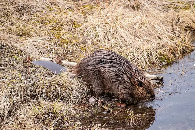 Mammal
American beaver
Castor canadensis
North America's largest rodent, a keystone species whose dams reshape whole streams at Yellowstone, Glacier, and ten other parks along the route.
-
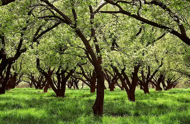 Plant
Apple
Malus domestica
The orchard tree people planted at Fruita in the 1880s, still bearing fruit you can pick, weigh and pay for at Capitol Reef.
-
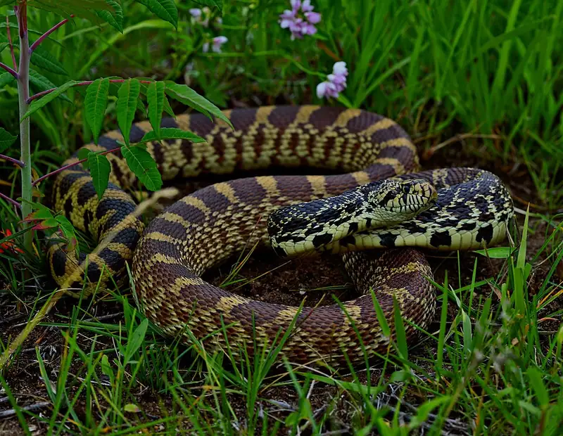 Reptile
Bullsnake
Pituophis catenifer sayi
A big, harmless snake that fakes being a rattlesnake — hissing, flattening its head, and shaking its tail in dry grass — to talk its way out of trouble.
-
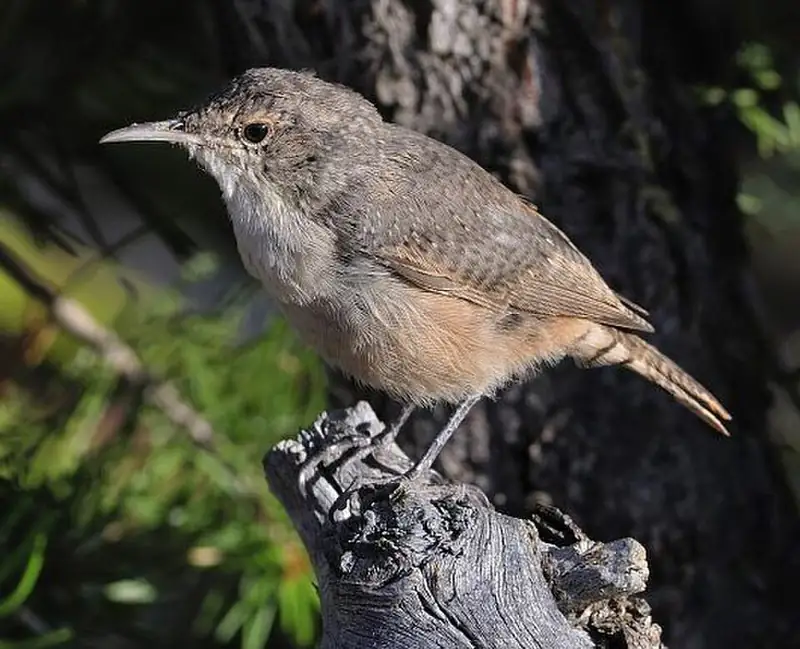 Bird
Canyon wren
Catherpes mexicanus
A small, rusty-brown songbird of canyon cliffs at Black Canyon, Arches, and Canyonlands, far more often heard than seen.
-
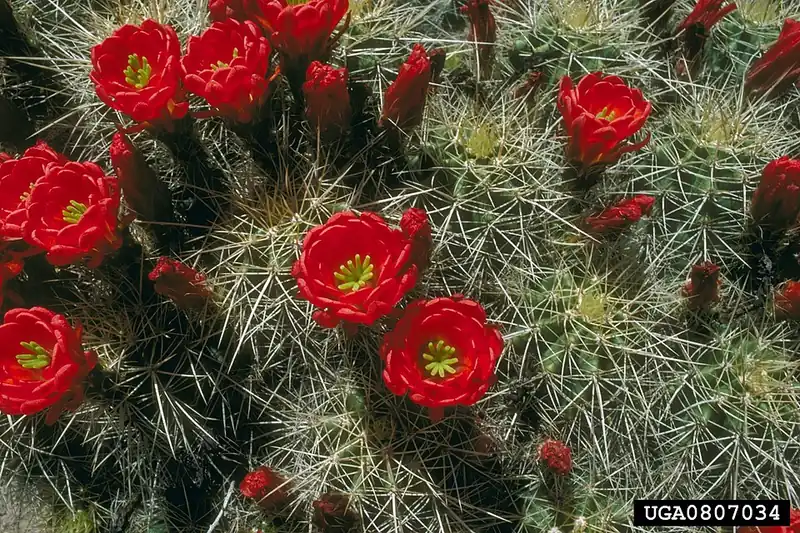 Plant
Claret cup cactus
Echinocereus triglochidiatus
A low, mounding desert cactus that bursts into bright red, cup-shaped flowers each spring on rocky ground across the Southwest.
-
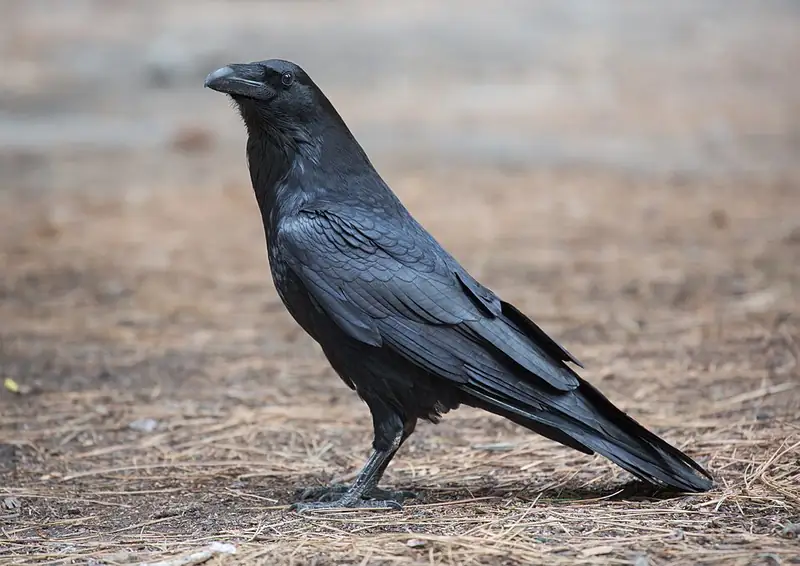 Bird
Common raven
Corvus corax
A big, glossy-black problem-solver that rolls and tumbles in the wind over the cliffs of Grand Canyon, Arches, and Canyonlands.
III
History
Who shaped this place
Indigenous nations
- Fremont Culture (ancestral) — Archaeologists call these people the Fremont Culture, named for the Fremont River that runs through Capitol Reef. They lived in pit houses and rock shelters in the park from about 300 to 1300 CE, farming corn, beans and squash along the waterways and floodplains.
- Hopi Tribe — NPS records that Hopi oral tradition associates the Fremont Culture with the Hopi — one of the strands that ties living pueblos to the people who farmed the Fremont River and cut the petroglyph panels along UT-24.
- Pueblo of Zuni — Zuni tradition is the other living strand NPS names in the same account of Fremont descendants, and the Pueblo of Zuni remains one of the tribes with an ongoing association with Capitol Reef.
- Ute Indian Tribe — Ute groups moved through the Capitol Reef area seasonally for hundreds of years, and NPS counts thirty-two tribes with an ongoing association with the park today, through current or historical traditional use.
- Paiute Indian Tribe of Utah — NPS puts the Paiute among the groups who used this country seasonally, in the same account that names the Ute and the Navajo, and the Paiute Indian Tribe of Utah carries that association today.
- Navajo Nation (Diné) — Navajo people were among the nomadic groups that moved through the Capitol Reef area seasonally for hundreds of years. Explorers and surveyors began reaching the region in 1854.
Advocates
- Ephraim P. Pectol↗ — Wayne County legislator and Torrey bishop, campaign 1914 to 1937
The primary booster of the park, who started the "Wayne Wonderland" publicity campaign in 1914 and, elected to the Utah legislature, lobbied for monument status through the 1930s. The 1937 monument proclamation followed his decades of slide shows and lectures.
- Joseph S. Hickman↗ — Wayne High School principal, co-founder of the campaign
Pectol's brother-in-law and co-founder of the publicity campaign. He drowned in Fish Lake in 1921, which stalled the campaign's early momentum. The Hickman Bridge trail carries his name.
- Charles Kelly↗ — First custodian and superintendent, 1943 to 1958
Historian and writer ("The Outlaw Trail," 1938) who ran the monument first as an unpaid volunteer custodian and then as its first paid superintendent. He wrote the early administrative history of the place.
- Frank E. Moss↗ — U.S. Senator (D-UT), 1971 enabling act
Senator Frank E. Moss sponsored S. 29, the act that elevated the monument to a national park under Public Law 92-207 in 1971. The same Moss shepherded Canyonlands into existence in 1964.
Detractors
- Local ranchers — 1969 expansion and 1971 park bill
Ranchers contested the 1969 LBJ expansion over grazing leases inside the enlarged boundary. The 1971 park bill was scaled back, releasing some grazing land to settle the claims.
- Uranium mining interests — Mid-century, Cathedral Valley
Uranium claims in the Cathedral Valley area met federal protection; some claims were grandfathered in the boundary negotiation that produced the 1971 park.
Timeline
Pectol and Hickman start the Wayne Wonderland campaign
Wayne County legislator Ephraim Portman Pectol and his brother-in-law Joseph S. Hickman began publicizing the area as "Wayne Wonderland" through slide shows, photographs, and lectures to railroad and state officials. They promoted country that the ancestral Fremont Culture and, after them, the Ute and Southern Paiute peoples had long used.
Capitol Reef National Monument proclaimed
President Franklin D. Roosevelt signed Presidential Proclamation 2246 on August 2, 1937, creating Capitol Reef National Monument at 37,711 acres. The name pairs the white Navajo Sandstone dome that early visitors thought resembled the United States Capitol with the Waterpocket Fold "reef" that blocked wagon travel.
Charles Kelly becomes volunteer custodian
Local historian and writer Charles Kelly was appointed the monument's first custodian, an unpaid post he and his wife Harriette ran largely alone. He became the first paid superintendent when the monument opened to the public in 1950.
UT-24 paved through the Fremont River gorge
Paving the state highway through the Fremont River gorge, which physically cuts through the park, was the inflection point for visitation. Geographic isolation had kept attention low for decades; Torrey had been a day's wagon ride from anywhere.
LBJ expands the monument
President Lyndon Johnson enlarged the monument to roughly 254,000 acres by proclamation in one of his last acts in office. Local ranchers contested the expansion, and the later park bill was scaled back to release some grazing land.
Elevated to national park
President Richard Nixon signed Public Law 92-207 on December 18, 1971, establishing Capitol Reef National Park at 241,904 acres after land subtractions to settle grazing claims. The enabling bill was S. 29, sponsored by Senator Frank E. Moss of Utah. The park was formally dedicated April 7, 1972.
Named an International Dark Sky Park
DarkSky International certified Capitol Reef as an International Dark Sky Park, recognizing the night skies over the Waterpocket Fold and the Fruita valley. The Entrada Institute in Torrey hosts dark-sky events.
About 1.4 million visitors, a record year
Capitol Reef recorded roughly 1.4 million visitors in 2024, a record. Visitation grew about 81 percent from 2014 to 2024, the largest decade increase of any Utah Mighty 5 park, as the long-overlooked park became a late beneficiary of the Mighty 5 campaign.