Navajo Nation
A nation today
Background
A tribal government was established in 1923, after oil was found on Navajo land in the early 1920s and American oil companies wanted to lease it. Eighty-eight delegates sit in the Council Chambers at Window Rock and speak for 110 chapters. The Nation reorganized in 1991 into three branches, executive, legislative and judicial, and legislative work between sessions happens in twelve standing committees. Diné Bikéyah, or Navajoland, covers more than 27,000 square miles, and the Nation says that is larger than ten of the fifty states. The Nation says its population now passes 250,000. In May 1942 the first 29 Navajo recruits went to boot camp and then to Camp Pendleton, California, where they built a dictionary and a code. That code carried messages through every assault the U.S. Marines launched in the Pacific between 1942 and 1945, and about 400 Navajos were trained as code talkers.
Visit and learn
Monument Valley Navajo Tribal Park
The Tribe's name for the valley is Tse’Bii’Ndzisgaii. The loop road runs 17 miles, over rough terrain and deep sand dunes, and the department does not admit motorcycles onto it. Entry is first come, first served, and the department asks visitors to plan for long waits and poor weather in peak season. The Wildcat Trail runs 1.5 miles from the visitor center.
https://navajonationparks.org/navajo-tribal-parks/monument-valley/
Cottonwood Campground at the heritage area
Half a mile south of the Canyon de Chelly National Monument welcome center, the campground takes tents and RVs, with a picnic table and a barbecue grill at each site. It is open year round with fewer sites from October through March. There are restrooms but no showers and no RV hookups, and the office is open 8 a.m. to 5 p.m. seven days a week. Navajo Parks and Recreation runs it under a cooperative management agreement with the National Park Service, and all the Tribe's park areas at Canyon de Chelly are reached by guided tour.
https://navajonationparks.org/navajo-tribal-parks/tseyi-dine-heritage-area/
Tribal lands have their own laws. Check the nation's site before you visit.
Parks on its homelands
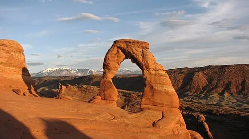
Arches National Park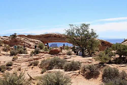 Canyonlands National Park
Diné Bikéyah, or Navajoland, is what the Navajo Nation calls the land it holds in Utah, Arizona and New Mexico, more than 27,000 square miles, which its own history page says is larger than ten of the fifty states. Source
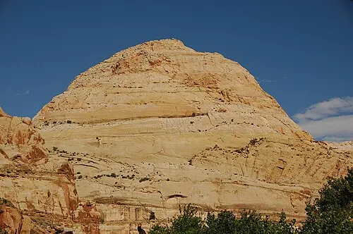 Capitol Reef National Park
Navajo people were among the nomadic groups that moved through the Capitol Reef area seasonally for hundreds of years. Explorers and surveyors began reaching the region in 1854. Source
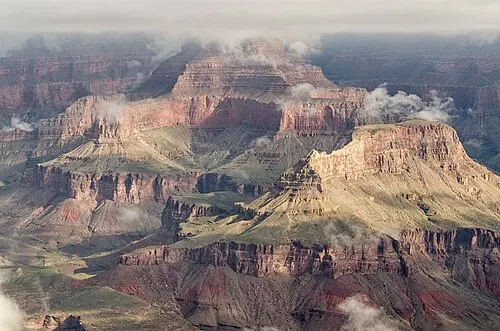 Grand Canyon National Park
The Navajo Nation is Diné Navajo Nation on the park's list of eleven associated nations, where the park also lists Navajo Nation Parks & Recreation. Eleven tribes are associated with the canyon, and three of them share a boundary with the park. Source
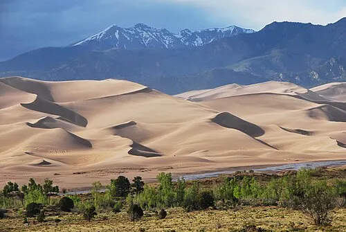 Great Sand Dunes National Park and Preserve
The park gives the dunes the Diné name Tsé-whíz-hosh, "sand comes back down on you," and publishes a Navajo (Diné) video presented by tribal members. Source
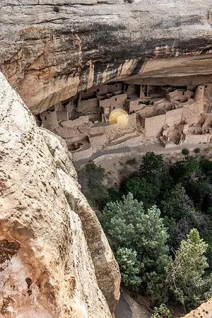 Mesa Verde National Park
Diné members of Mesa Verde's Cultural Resources Department worked as a stabilization crew to protect the structures of the park. NPS places the park just southwest of the northern boundary of the traditional Diné homeland, which runs across northeast Arizona, northwest New Mexico, and southeast Utah. Source
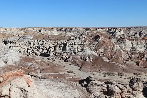 Petrified Forest National Park
The Puerco River, a tributary of the Little Colorado, runs through Petrified Forest National Park, and NPS records that the Little Colorado is still a vital resource for the Navajo Nation. The river runs 315 miles from the White Mountains of Arizona west to the Colorado in the Grand Canyon, and people have been using it for about 8,000 years. Source
Programs
Navajo Nation Parks and Recreation
By its own account the Navajo Nation Parks and Recreation Department is one of the oldest programs in the Navajo Nation government. It was established in 1957 by the Navajo Nation Tribal Council under Tribal Council CAU-48-64. It oversees the Little Colorado River Gorge, Lake Powell, Monument Valley and Four Corners Monument tribal parks, the Tséyi’ Diné heritage area at Cottonwood Campground by Canyon de Chelly, Camp Asaayi in Bowl Canyon, the San Juan River and the Navajo Veterans Memorial Park at Window Rock. Its stated mission is to manage tribal parks, monuments and recreation areas for the long-term benefit of the Navajo People, and its stated vision is stewardship of the tribal parks for the sustainability of the Nation's natural resources.
Navajo Nation Council
The legislative branch's own site carries news, legislation, committee information and updates on the work of the Council Delegates, along with a standing committee roster and support staff list.
Affiliations
Grand Canyon National Park
Grand Canyon's list of eleven tribes with historic connections to the lands and resources now found inside the park names the Navajo Nation, with Arizona as its state.
Mesa Verde National Park
Mesa Verde works with 27 associated Pueblos, Tribes and Nations. NPS says Navajo members from Shiprock, New Mexico were among the primary builders of the park's roads and buildings and served on its stabilization and archaeological crews.
Great Sand Dunes National Park and Preserve
The Navajo Nation is on Great Sand Dunes' list of affiliated tribes. The park publishes a video on the dunefield presented by tribal members, and credits Navajo Nation staff with ongoing consultation on park programs.
Arches National Park
The Nation is on the list of ten tribes and governments whose homelands Arches says the park sits inside.
Colorado National Monument
The monument says the Navajo Nation, together with four Ute governments, maintains cultural ties to the lands within and around it.
Sources
- https://www.govinfo.gov/content/pkg/FR-2026-01-30/html/2026-01899.htm
- https://www.navajo-nsn.gov/History
- https://navajonationparks.org/
Checked September 2026.