UT
Canyonlands National Park
Four desert districts split by the Green and Colorado rivers. Island in the Sky is about 40 minutes from Moab, and The Needles is 90 minutes each way.
Established
The park film at Island in the Sky starts with the map. A marker comes up on the mesa where we were sitting. The camera pulls back until our corner of the park is a corner of the map, and then pulls back again until you cannot find us at all.
Canyonlands is four districts. Island in the Sky has the paved road, about 40 minutes from Moab. The Needles is about 90 minutes each way, down US-191 and UT-211. The Maze can take a week and a four-wheel-drive. The fourth district is the rivers themselves, the Green and the Colorado, and they are why none of the other three connect.
We had given the park a day and a half. The film ended and I did the arithmetic: one district for the afternoon, the same one the next morning, the other three left standing. That was the whole mistake. Four districts under one park name, and we had budgeted for one of them. The day and a half is in Two Oaths.
After the film we drove out to Willow Flat. Twelve sites, first-come, no water. Erika drove the loop while Big and Little ran ahead to the numbered posts. We took a site at the end, backed the rig in, and leveled it. Then we went back out to the rim.
Mesa Arch is a 0.6-mile loop. The arch is 27 feet long and sits on the rim. The opening frames the White Rim below and the La Sal Mountains behind. There is no railing. The rock runs out to the arch and then the mesa drops. We took the obvious picture, then stood there a while longer.
Whale Rock is 0.8 mile round trip with 141 feet of elevation change, and it is less a trail than a route up the back of a sandstone dome. It runs from the tail of the whale to the blowhole at the top. The NPS calls it a moderate scramble with steep drop-offs and asks for good shoes. Big went up first and found a line. Little took a different one, and both of them came over the top. From there the mesa went out flat in every direction and then broke into canyon.
That night we built a fire and found the marshmallow bag empty. We ate the graham crackers and the chocolate anyway, sitting close to the flames while the light went out of the mesa and the cold came down.
We left Willow Flat and stopped at the visitor center on the way out. The ranger had the badges. Big and Little stood at the desk and took the Canyonlands Junior Ranger oath. Then we drove down the mesa to Moab for fuel and back to Arches.
This is homeland. The NPS names 27 nations with ancestral and traditional ties to this land, among them the Hopi, the Navajo, the Ute, the Zuni, and the Southern Paiute. Newspaper Rock, on the way into the Needles, carries hundreds of figures pecked over roughly 1,500 years by Ancestral Puebloan, Ute, and earlier makers, and the descendant nations are still here. We kept our hands off the rock. Skin oils damage the patina the figures are cut into.
Two things shape a visit here. The first is supplies: there is no food in any district and no water at any trailhead, so the jugs, the lunch, and the fuel come out of Moab before the turnoff. The Island in the Sky visitor center has the only water in that district, and cell service gets unreliable past it. The second is heat. The rim runs in the 60s to 80s in spring and fall. June through August it is 95 to 105 on the mesa and hotter below, with monsoon storms after mid-July that can close the slot routes within hours.
From our visit
- Willow Flat. Twelve first-come sites and no water. The site at the end of the loop was ours, and the rig was level before we went back out to the rim.
- Mesa Arch. A 0.6-mile loop to a 27-foot arch on the rim. No railing, and the frame is the White Rim below with the La Sal Mountains behind. We took the obvious picture and stayed until the light moved.
- Whale Rock. A 0.8-mile scramble up the back of the dome, 141 feet of gain. Big found one line, Little found another, and both of them were on top before I was.
The rest of that visit is in Two Oaths, and we left Moab in the morning for Capitol Reef, tank full and jugs refilled.
I
Basic info
- Established
- 1964
- Area
- 337,598 acres
- Visitors (2024)
- 818,492
- Elevation
- 3,900–7,180 ft
- Designation
- National Park (1964)
II
Logistics
Before you go
- Getting there
- Reach Island in the Sky on UT 313 from US 191 north of Moab, and The Needles on UT 211 from US 191 south of Moab. No road connects the districts inside the park, so plan each as its own drive. NPS
- How many days
- NPS says visiting more than one district in a day isn't practical, so give Island in the Sky at least a day and The Needles a separate one. In Island in the Sky, half a day covers Grand View Point, Green River Overlook, and the 0.6-mile Mesa Arch loop. A full day adds longer mesa-top trails. NPS
- Entrance fee
- Entry costs $30 per private vehicle (2026), and you need no timed-entry reservation. An America the Beautiful pass covers entry. NPS
- Pets
- Only on front-country roads, parking areas, campgrounds, and picnic areas, on a leash 6 feet or shorter (2026). Pets are barred from all trails, overlooks, buildings, the backcountry, and river trips. NPS
Seasons
Spring
- Peak season and the family window, March through May. No timed entry. Mesa Arch sunrise draws tripods by the dozen at first light.
- 60s to 80s °F days, 30s to 50s °F nights. Needles wildflowers in April.
- The best window for the family. Drive Island in the Sky from Moab in a day; add the Needles if you have a second day and the 90-minute drive each way.
Summer
- Heat is the limiting factor on the mesa, hotter still on the White Rim 1,200 feet below. Monsoon storms arrive in mid-July and close slot routes within hours.
- 95 to 105 °F on the rim. Flash floods can shut Salt Creek and Horseshoe Canyon fast.
- Hike before 9 a.m. or after 5 p.m., or skip the exposed trails. There is no shade at the overlooks.
Fall
- Second-best season, September and October. Thinner crowds than spring, cooler rock.
- 70s °F days, 40s to 50s °F nights. Cottonwoods yellow in late October.
- Cooler clifftop walking and quieter overlooks. Nights get cold; pack layers for a Willow Flat camp.
Winter
- The quietest season. Roads stay passable, the Needles visitor center runs reduced hours.
- 30s to 50s °F days, 10s to 20s °F at night. Snow dusts the Needles spires.
- Short daylight and cold mornings, but the rim is yours. Check current visitor-center hours with the NPS before relying on water or staffing.
Canyonlands National Park with kids
Canyonlands is four districts split by the Green and Colorado rivers, with no road between them. For a family, the realistic trip is Island in the Sky for a day (about 40 minutes from Moab), plus the Needles if there is a second day and the 90-minute drive each way. The headline Island stops are short walks from the car: Mesa Arch, Grand View Point, Green River Overlook. There is no food in any district and no water at any trailhead, so the planning is front-loaded in Moab.
- Junior Ranger booklets are free at the Island in the Sky and Needles visitor centers and at Hans Flat for the Maze.
- No water at any trailhead. Bring a gallon per person per day; the Island in the Sky visitor center has the only water in that district.
- Mesa Arch (0.6 mi) and Grand View Point (1.8 mi flat clifftop) are the easiest Island wins. Mesa Arch has no railing at the rim; keep a hand on small hikers.
- Cave Spring in the Needles (0.6 mi loop, two wooden ladders) is the short hike kids remember.
- Strollers are useless park-wide; bring a kid carrier. There is no food in any district, so pack lunch and resupply in Moab first.
Accessibility
Several Island in the Sky overlooks are short, near-level walks from the parking area to a railed rim. Grand View Point's first overlook and Green River Overlook are the most accessible big-canyon views in the park. Most named trails beyond those are unimproved slickrock with open exposure and no railing.
- Green River Overlook: a near-level paved approach to a railed rim above the Green River side, steps from the parking area.
- Grand View Point: the railed first overlook is a short walk from the lot; the 1.8-mile trail to the point itself is flat but cairned over open slickrock with a sheer drop on one side.
- Mesa Arch: a 0.6-mile loop on uneven rock to a rim arch with no railing; hold small hikers near the edge.
- The Needles trails and the White Rim Road are unimproved; the White Rim is a 100-mile 4WD or mountain-bike route, not a passenger-car drive.
Things you can't miss
Natural places
Mesa Arch↗
A pothole arch on the very edge of the Island in the Sky rim, framing an open drop to the White Rim country below. The marked loop from the Mesa Arch parking area runs about 0.6 mile round-trip per NPS. This is the most-photographed sunrise spot in the park; tripods line the rim at first light from April through October. There is no railing at the arch, so a family keeps a hand on small hikers near the edge.
Grand View Point↗
The overlook at the end of the Island in the Sky road, and the biggest canyon view a family can reach on foot. The White Rim bench sits about 1,200 feet below the mesa edge, and the Green and Colorado cut deeper still below that. A railed first overlook is a short walk from the lot; a flat 1.8-mile round-trip continues along the rim to the point itself, per NPS.
Green River Overlook↗
A short, near-level walk from the parking area to a railed rim above the Green River side of the mesa, looking down the Soda Springs Basin and the White Rim toward the river. Wallace Stegner wrote about this view in The Sound of Mountain Water (1969). It sits beside Willow Flat Campground, so it pairs with a camp night and an easy sunset for tired legs.
The Needles↗
The banded red-and-white spires that name the second district, eroded from Cedar Mesa Sandstone. The Needles takes about 16 percent of the park's visits and is the destination for families who want longer day hikes or a backpack. It sits in the shared homeland of the Pueblo, Ute, Navajo, and Paiute nations the NPS names, and holds Ancestral Puebloan dwellings and granaries along Salt Creek. Reached by US-191 south from Moab, then west on UT-211, about 90 minutes one way.
Upheaval Dome↗
A crater about three miles across with a ring of tilted rock layers around a central uplift. Two explanations have competed. One reads it as a collapsed salt dome. The other reads it as the eroded scar of a meteorite impact, and shocked-quartz evidence reported by researchers supports that impact reading. The USGS Geologic Map of Canyonlands (SIM 3137) lays out the geology. A 0.8-mile round-trip reaches the first crater overlook; a second runs about 1.8 miles round-trip.
Nearby attractions
Dead Horse Point State Park↗
A state-park overlook about 2,000 feet above a gooseneck bend of the Colorado River, on the same mesa road as Island in the Sky off UT-313. It carries a separate day-use fee from the national park. The visitor center, paved overlook, and yurt camping make it an easier first big view with kids than driving the full Island loop, and it is a few minutes from the Island turnoff.
Newspaper Rock↗
One rock face carrying hundreds of petroglyphs pecked over roughly 1,500 years by Ancestral Puebloan, Ute, and earlier makers. It is a roadside stop on UT-211 on the way into the Needles, about 12 miles before the entrance, with a short flat path to the panel. The BLM asks visitors not to touch the rock: skin oils damage the desert-varnished patina the figures are cut into. The makers' descendant nations live here still.
Moab↗
The supply town for the whole region: groceries, gas, water, gear, the nearest hospital, and the only reliable cell coverage near the park. There is no food in any district of Canyonlands and no water at any trailhead, so the jugs, the lunch, and the gas tank all get filled here first. Moab bases both Island in the Sky (about 40 minutes) and the Needles (about 90 minutes), and Arches is a few minutes the other way, so a family can reach three parks from one motel strip.
Places to stay
Willow Flat Campground↗
The only campground inside Island in the Sky, 12 sites near the Green River Overlook, per NPS. First-come, first-served year-round, no reservations, and it fills early in spring and fall. Vault toilets, no water, no hookups; fill jugs at the visitor center or in Moab. It is the closest bed to Mesa Arch at sunrise, which is the reason to take a site.
The Needles Campground↗
26 sites among the slickrock and spires of the Needles, the base camp for Cave Spring, Chesler Park, and the Joint Trail. Sites are listed on Recreation.gov; the NPS says the campground is open year-round, so confirm the current reservation window before you count on it. Vault toilets, and water seasonally at the campground, which the NPS notes can change, so verify before relying on it.
Dead Horse Point yurts↗
Yurts and campsites on the mesa at Dead Horse Point State Park, minutes from the Island in the Sky turnoff, with the overlook and visitor center on site. A roofed alternative for a family that does not want to tent-camp at Willow Flat. Reserved through Utah State Parks, and they book months ahead for spring and fall.
Viewpoints and camping
Grand View Point Overlook↗
The railed overlook a short walk from the parking area at the end of the Island in the Sky road, before the trail to the point continues. The drop to the White Rim is about 1,200 feet. This is the most accessible big-canyon view in the park for someone who does not want to hike far, and the place to stand at the road's end and see how deep the country runs.
White Rim Road↗
A 100-mile dirt loop around and below the Island in the Sky mesa, dropping in on the Shafer switchbacks and run as a two-to-four-day high-clearance 4WD or mountain-bike trip. Day use and overnight both need a permit from Recreation.gov, and overnight permits draw months ahead. Not a drop-in drive, but worth naming so a family knows the road below the rim is there for a future trip.
Trails worth the time
Cave Spring Trail↗
A 0.6-mile loop in the Needles, under a long rock overhang past a spring, an old cowboy line camp left in place, and a pictograph panel, with two wooden ladders kids tend to remember. Easy per NPS aside from the ladders. The Needles is shared homeland of the Pueblo, Ute, Navajo, and Paiute nations NPS names; do not touch the panel. The best short hike in the district for a family.
Whale Rock↗
A 0.8-mile round-trip climb up the side of a sandstone dome, from its tail to its blowhole, for broad views over the Island in the Sky. The route is moderate, a mesa-top scramble of 141 feet, and the NPS asks for soles with good traction and care near the steep drop-offs. Great for kids who like to scramble on rock, and the whole route is the rock itself.
Our pick for things to do nearby
Junior Ranger program↗
The reliable kid activity in a park with no in-park dining and no guaranteed daily programs. Free booklets are at the Island in the Sky and Needles visitor centers and at Hans Flat for the Maze, per NPS. Kids work through the activities across a day of overlooks and hikes, then get sworn in by a ranger for a badge. Pick up the booklet on arrival so it rides along all day.
Common questions
- Which district should we do with kids?
- Island in the Sky, about 40 minutes from Moab, holds 76.7 percent of visits because the big views are short walks from the car: Mesa Arch, Grand View Point, Green River Overlook. If you have a second day and the 90-minute drive each way, the Needles adds Cave Spring and Newspaper Rock on the way in. The Maze and the Rivers district are serious 4WD or multi-day boat trips, not family drop-ins.
- When should we go?
- April and May, or September and October. Spring (60s to 80s °F days) is the prime family window; fall is the cooler, quieter second-best. Avoid June through August: the rim runs 95 to 105 °F, it is hotter below, and monsoon flash floods after mid-July close slot routes within hours.
- Where do we get water, gas, and food?
- All of it in Moab. There is no food in any district of Canyonlands and no water at any trailhead. The Island in the Sky visitor center has the only water in that district. Fill the jugs and the tank and pack lunch before you drive in.
- Do we need a timed-entry reservation?
- No. Canyonlands requires no timed entry. Entry is $30 per vehicle for 7 days and covers all four districts. The White Rim Road, Salt Creek, Horseshoe Canyon, and overnight backcountry each need a separate permit from Recreation.gov.
- Is there cell service in the park?
- No, not past the visitor center in any district. Download maps and any permits before you drive in.
- Where do we camp or sleep?
- Willow Flat at Island in the Sky has 12 first-come sites and no water. The Needles Campground has 26 sites, some reservable on Recreation.gov in spring and fall. Dead Horse Point State Park, minutes from the Island turnoff, rents yurts. Everything else is in Moab; there is no in-park lodge.
Wild things at Canyonlands National Park
See all 12 →-
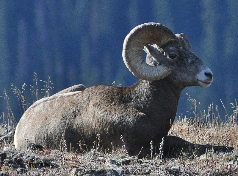 Mammal
Bighorn sheep
Ovis canadensis
A wild sheep of cliffs and canyons, where rams carry heavy curled horns and both sexes cross steep rock other animals can't.
-
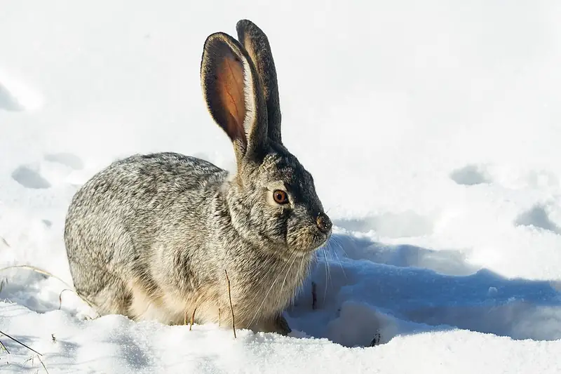 Mammal
Black-tailed jackrabbit
Lepus californicus
A big-eared hare of Joshua Tree, Lava Beds, Arches, and Canyonlands that dumps body heat through those ears and outruns coyotes in zigzags at 40 miles an hour.
-
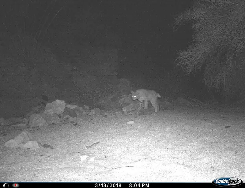 Mammal
Bobcat
Lynx rufus
A small wildcat about twice the size of a house cat, common but rarely seen, that can bring down prey many times its own weight.
-
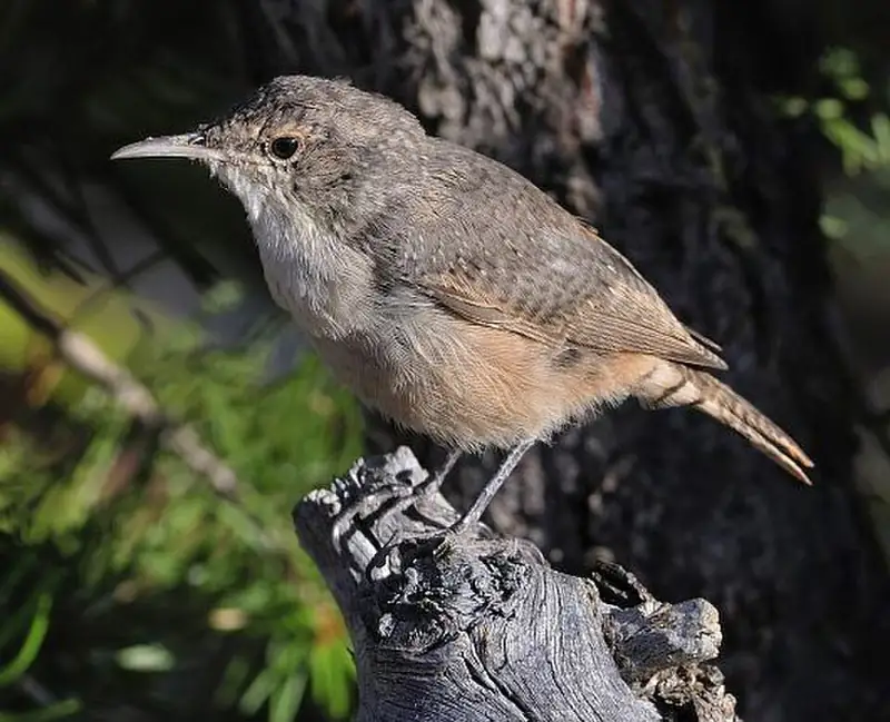 Bird
Canyon wren
Catherpes mexicanus
A small, rusty-brown songbird of canyon cliffs at Black Canyon, Arches, and Canyonlands, far more often heard than seen.
-
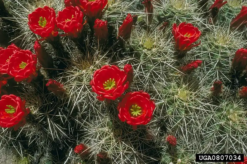 Plant
Claret cup cactus
Echinocereus triglochidiatus
A low, mounding desert cactus that bursts into bright red, cup-shaped flowers each spring on rocky ground across the Southwest.
-
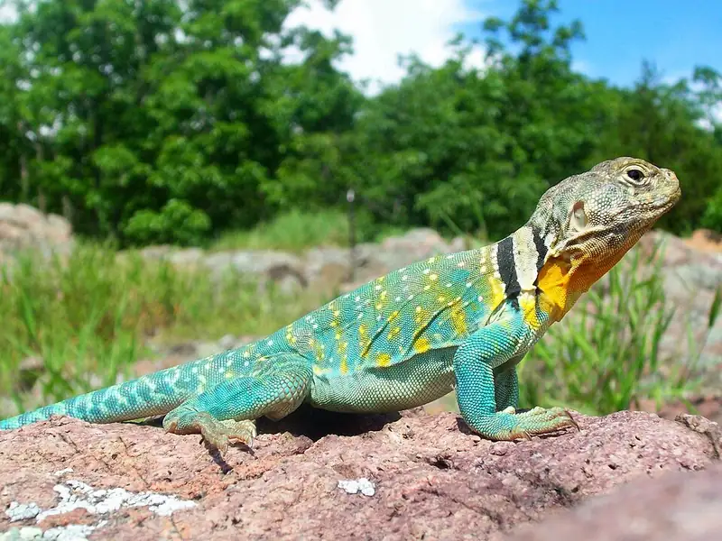 Reptile
Common collared lizard
Crotaphytus collaris
A bright, big-headed lizard with two black neck bands that can sprint on its back legs like a tiny dinosaur across desert rock.
III
History
Who shaped this place
Indigenous nations
- Hopi Tribe — A sovereign nation in northeastern Arizona, the Hopi Tribe holds a reservation of more than 1.5 million acres made up of 12 villages on three mesas, and the Tribe says the Hopi have lived in Hopitutskwa since time immemorial.
- Kaibab Band of Paiute Indians — The Band calls its people the Kaivaviching'w and its language kaivavich nengwe, and it governs a 120,840-acre reservation on the Arizona Strip about 50 miles north of the Grand Canyon.
- Navajo Nation — Diné Bikéyah, or Navajoland, is what the Navajo Nation calls the land it holds in Utah, Arizona and New Mexico, more than 27,000 square miles, which its own history page says is larger than ten of the fifty states.
- Ohkay Owingeh — Ohkay Owingeh is a Tewa-speaking pueblo in the Rio Grande valley, and the state's tribal directory lists it at P.O. Box 1099, Ohkay Owingeh.
- Paiute Indian Tribe of Utah — Congress restored federal recognition to the Paiute Indian Tribe of Utah on April 3, 1980, establishing it as the federally recognized body of five Nung'wu bands, Cedar, Indian Peaks, Kanosh, Koosharem and Shivwits, each of which manages its own lands near its traditional territory.
- Pueblo of Acoma — Acoma Pueblo's own history says the name means "a place always prepared," and the mesa has been continuously occupied from at least A.D. 1200.
- Pueblo of Isleta — Isleta Pueblo sits in the Rio Grande Valley 15 miles south of Albuquerque, and its own site says the Pueblo was established in the 1300s.
- Pueblo of Jemez — Jemez Pueblo, or Walatowa, means "this is the place" in Towa, and the Pueblo dates its ancestors' move into the Cañon de San Diego to the late 13th century.
- Pueblo of Laguna — Laguna Pueblo sits at the foothills of Mount Taylor, 45 miles west of Albuquerque, and its reservation covers about 500,000 acres in four New Mexico counties.
- Pueblo of Nambe — Nambé Pueblo, or Nanbé Owingeh, takes its name from the Tewa words nanbe', "rounded earth," and owingeh, "village," and has stood at its current site since the 14th century.
- Pueblo of Picuris — Picuris Pueblo sits in Taos County about 20 miles southwest of Taos, and it is one of the two Tiwa-speaking pueblos the Poeh Cultural Center names, with Taos.
- Pueblo of Pojoaque — Pojoaque Pueblo calls itself P'o-suwae-geh Owingeh, "Water Drinking Place Village," and runs the Poeh Cultural Center and Museum.
- Pueblo of San Felipe — San Felipe Pueblo, or Katishtya, sits at the foot of Black Mesa in the middle Rio Grande valley, and its own site says its people have lived in the Southwest from time immemorial.
- Pueblo of San Ildefonso — San Ildefonso Pueblo is listed by the state tribal directory at 02 Tunyo Po, Santa Fe, and runs its own Tewa Language program and cultural resources program.
- Pueblo of Sandia — Sandia Pueblo sits on 22,877 acres on the east side of the Rio Grande adjacent to Albuquerque, and its own site says the present site has been home since 1300 AD.
- Pueblo of Santa Ana — Santa Ana Pueblo, or Tamaya, sits along the Rio Grande in Sandoval County, and its own history says Tamaya is made up of three villages: Rebahene, Ranchitos, and Chicale.
- Pueblo of Santa Clara — Santa Clara Pueblo is one of the six Tewa-speaking villages of northern New Mexico, and its people call themselves Kha'P'o, the people of the Valle.
- Pueblo of Taos — Taos Pueblo's own history says its people have cultivated the Taos valley since about 900 AD, and its multi-storied adobe homes were built between 1000 and 1450 AD.
- Pueblo of Tesuque — Tesuque Pueblo has existed in the foothills of the Sangre de Cristo Mountains since as early as 1200 AD, and its name is the Spanish variation of a Tewa name meaning "village of the narrow place of the cottonwood trees."
- Pueblo of Zia — Zia Pueblo occupies a basalt mesa in north-central New Mexico, and its own history says Keresan-speaking people have continuously occupied the site since the 13th century.
- San Juan Southern Paiute — A reservation for the San Juan Southern Paiute was established in 1907 as part of the Navajo reservation. The Tribe received federal recognition in 1990, when the Navajo people gave it 5,100 acres near Tuba City, Arizona and another 300 acres near Lake Powell in Utah.
- Santo Domingo Pueblo — Santo Domingo Pueblo, also called Kewa, lies on the Rio Grande at Interstate 25 Exit 259, and its people trace their ancestry to Mesa Verde and Chaco Canyon.
- Southern Ute Indian Tribe of the Southern Ute Reservation — The Southern Ute Indian Tribe greets visitors on its own site in its language, Máykh, and its reservation lies in southwest Colorado.
- Ute Indian Tribe — The Tribe's own site gives the Ute name as Land of the Sun, says the Utes originally came from Colorado, and says the Tribe manages 1.3 million acres of trust land.
- Ute Mountain Ute Tribe — About 553,008 acres of reservation in Montezuma and La Plata counties in Colorado and San Juan County in New Mexico belong to the Ute Mountain Ute Tribe, which is the Weenuche band of the Ute Nation of Indians.
- White Mesa Ute — White Mesa is one of the two Ute Mountain Ute Tribe communities; the other is Towaoc, Colorado, where the tribal administration sits.
- Zuni Tribe of the Zuni Reservation — The Zuni Pueblo and Acoma Pueblo have used a 7.5-mile trail across the lava flows at El Malpais for at least a thousand years, still marked by cairns.
Advocates
- Bates Wilson↗ — Superintendent of Arches Monument 1949-1972; first superintendent of Canyonlands, 1964
The "Father of Canyonlands." He hauled politicians, photographers, and writers into Salt Creek and the Confluence on jeep tours through the late 1950s and early 1960s, including Interior Secretary Stewart Udall in 1961. The trips, not a brochure, built the case for the park.
- Stewart L. Udall — Secretary of the Interior under JFK and LBJ
After his 1961 jeep trip with Bates Wilson, Udall made Canyonlands a personal priority and pushed it through the Kennedy and Johnson administrations toward the 1964 establishment.
- Frank E. Moss↗ — U.S. Senator (D-UT), bill sponsor
Introduced and shepherded S. 27 through the Senate against a Utah delegation that otherwise opposed federal designation. Without him the 1964 bill stalls.
- Edward Abbey — Writer
Desert Solitaire (1968) and The Monkey Wrench Gang (1975) did more for the park's public reputation than any agency campaign. The Maze is the hideout in the second book.
Detractors
- Utah delegation and Governor George Dewey Clyde — 1964 establishment
Most of the Utah congressional delegation, except Senator Moss, and Governor Clyde opposed federal designation as a constraint on uranium, oil, and grazing leases. The fight cut the original million-acre-plus proposal to 257,640 acres.
- San Juan and Grand County commissions — 1971 expansion
County commissions and mining and grazing interests in the Maze and Needles districts opposed the 1971 expansion and pushed for boundary reductions through the 1960s.
Timeline
Udall rides the canyon country with Bates Wilson
Interior Secretary Stewart Udall took a jeep tour into the canyons with Arches superintendent Bates Wilson, who had been hauling politicians, photographers, and writers into Salt Creek and the Confluence since the late 1950s. Udall made the park a personal priority. The Ute, Pueblo, Navajo, Paiute, and other nations had used this country for millennia before any of these trips.
National Geographic runs a Canyonlands feature
By the time the establishment bill came to a vote, the country had pictures. The jeep tours and the magazine coverage did the work that no government brochure could.
Canyonlands National Park established
President Lyndon B. Johnson signed Public Law 88-590 on September 12, 1964, establishing Canyonlands at 257,640 acres. The original Wilson and Udall proposal had been for more than a million acres; the political compromise cut it to a quarter of that. Senator Frank E. Moss shepherded the bill (S. 27) through a Utah delegation that otherwise opposed it.
Desert Solitaire published
Edward Abbey's book did more for the public reputation of this canyon country than any agency campaign. He later called Canyonlands the most weird, wonderful, magical place on earth.
Park expanded to its current size
President Richard Nixon signed Public Law 92-154 on November 12, 1971, expanding Canyonlands to 337,598 acres, the same day he elevated Arches to a national park under Public Law 92-155. The Horseshoe Canyon detached unit was added to protect the Great Gallery rock-art panel. San Juan and Grand County commissions opposed the expansion.
911,594 visitors, recent peak
Visitation has risen by roughly half since 2014, concentrated at Island in the Sky because it is about 40 minutes from Moab. The Needles takes about 16 percent of visits; the Maze, essentially trackless, takes about 3 percent.
About 818,000 visitors
Canyonlands drew 818,492 visitors in 2024, well below the crowds at Arches a few minutes away. April, May, September, and October stay the comfortable months for a family.