ND
Theodore Roosevelt National Park
Badlands cut by the Little Missouri in western North Dakota, homeland of the Mandan, Hidatsa, and Arikara, where Theodore Roosevelt ranched from 1883.
Established
We spent five days in Theodore Roosevelt, and a herd of bison had the last word: half a mile into Buckhorn Trail in the North Unit, they were standing across the path, and we turned around rather than argue about right of way. That evening is its own story, written up in the bison had the trail before we did. The structured sections below are the homework we did before we drove in: which unit earns the day, which short hikes fit small legs, the logistics that catch families off guard on the Northern Plains. It held up.
This is three disconnected units strung along the Little Missouri River, and most of the visit is a driving plan. The 36-mile South Unit Scenic Loop near Medora is the wildlife drive: bison, prairie-dog towns, and a feral horse herd, all visible from the car, with the Wind Canyon Trail (0.4 mi) for the shortest hike to a real view — we did it with a ranger, who pointed out a great horned owl nest site in the canyon walls and the prairie rattlesnakes living in the grass underfoot. The North Unit, about 70 miles north near Watford City, carries deeper canyon walls, bighorn sheep, and far fewer cars; we hiked the Caprock Coulee Trail there before the Buckhorn herd turned us back. The drive between visitor centers ran close to the 1.25 hours we’d planned for. The Elkhorn Ranch Unit sits between them on a gravel road that is often impassable when wet; we skipped it. The Maltese Cross Cabin, Roosevelt’s 1883 ranch cabin, is a short indoor stop beside the South Unit Visitor Center, and worth the fifteen minutes.
The badlands are the homeland of the Mandan (Nueta), Hidatsa (Nuxbaaga), and Arikara (Sahnish), allied today as the MHA Nation of the Fort Berthold Reservation, just north and east of the park, with the Lakota to the south and the Apsáalooke (Crow) to the west. Roosevelt arrived in 1883 on land that was already home. The bison the park reintroduced in 1956 are now being transferred back to tribal herds, including MHA Nation lands, under an NPS surplus-bison program, a restoration that is still going on rather than finished.
Two nights of it were spent off the park entirely, boondocked in the Little Missouri National Grassland outside Medora, no hookups and no neighbor close enough to hear — the clearest sky of the trip either way. Medora itself, the 1883 town at the South Unit gate, carried the rest: the Rough Riders Hotel’s dining room, the Pitchfork Steak Fondue, the Medora Musical, and the Theodore Roosevelt Presidential Library on a butte at the edge of the South Unit, looking out over the Little Missouri badlands. We went in September, when the light runs long and the drive between the units is easy — the window we’d been aiming for held.
I
Basic info
- Established
- 1978
- Area
- 70,447 acres
- Visitors (2022)
- 668,679
- Elevation
- 1,962–2,855 ft
- Designation
- National Memorial Park (1947)
- Designation
- National Park (1978)
II
Logistics
Before you go
- Getting there
- The South Unit entrance is in Medora, North Dakota, off I-94 Exits 24 and 27, 133 miles west of Bismarck. The North Unit is on US Highway 85 about 14 miles south of Watford City, 1 hour 10 minutes from the South Unit. NPS
- How many days
- The South Unit's 48-mile scenic loop from Medora takes 2 hours of driving alone. The North Unit's 28-mile out-and-back drive to Oxbow Overlook takes about 1 hour 15 minutes without stops. NPS times each drive but gives no day count. NPS Build a day-by-day plan
- Entrance fee
- Entry costs $30 per private vehicle for 7 days (2026). An America the Beautiful pass covers entry, and the park uses no timed entry. NPS
- Pets
- Leashed pets (6 feet or shorter) may use roads and shoulders, sidewalks, parking areas, campgrounds, and picnic areas (2026). Park trails are closed to pets, and the paved path from Medora to the Maah Daah Hey Trail is outside the park. NPS
Seasons
Spring
- Green-up and bird arrivals. Mud season can close the gravel road to the Elkhorn Ranch Unit, and the North Unit Scenic Drive above Oxbow Overlook can close for bighorn sheep lambing.
- 40s to 70s °F. Rapid green-up across the prairie benches.
- A good window before the summer heat and the river mosquitoes. Check road status at a visitor center before driving the Elkhorn gravel.
Summer
- Hot and busy. About 80 percent of the year's visits fall May through September per the base dossier, and most of them see only the South Unit.
- 90s °F and sometimes past 100, with violent afternoon thunderstorms. Mosquitoes are heavy along the Little Missouri in June and July.
- Drive the loops early or late for wildlife and cooler light. Evening ranger programs run at the Cottonwood Amphitheater in the South Unit.
Fall
- The best season. Cottonwoods along the Little Missouri turn gold in late September and early October, elk bugle, and the bison roundups run.
- 60s to 70s °F by day, cool nights.
- Long gold light, thinner crowds, and the easiest weather for the 70-mile drive between the South and North units.
Winter
- Cold and quiet. The South Unit Scenic Loop is often partly closed by snow and the Painted Canyon Visitor Center is seasonal, typically closed late fall through spring.
- Sub-zero cold and hard wind chill are common. Snow.
- Bighorn sheep are more visible in the North Unit, and Painted Canyon throws sharp light against snow. Dress for real cold and check road status first.
Theodore Roosevelt National Park with kids
Theodore Roosevelt is three disconnected units along the Little Missouri River, and the family plan is mostly a driving plan: the 36-mile South Unit Scenic Loop near Medora for bison, prairie dogs, and feral horses from the car, and the quieter North Unit, about 70 miles north near Watford City, for deeper canyon walls and bighorn sheep. The Maltese Cross Cabin beside the South Unit Visitor Center is short and indoor. The shortest hike to a real view is the Wind Canyon Trail, a 0.4-mile loop on the Scenic Loop.
- Junior Ranger booklets are at the South Unit, North Unit, and Painted Canyon visitor centers, so a family can earn one even on a short I-94 stop at Painted Canyon.
- The Maltese Cross Cabin tour is short and indoor and works for kids who want the Roosevelt story without a hike. Bring questions.
- Wind Canyon Trail (0.4 mi loop, about 50 ft of gain) is the shortest hike to a real view. Little Mo in the North Unit (0.7 or 1.1 mi) is the easy riverside option.
- Prairie-dog towns sit right along the South Unit Scenic Loop, visible from the car. Keep your distance: prairie-dog fleas can carry sylvatic plague.
- Bison have the right of way. NPS asks visitors to stay in the vehicle and keep 25 yards. People are gored on plains parks every year.
- Drive the South Unit Scenic Loop early or late. Bison, prairie dogs, and feral horses are all more active and closer to the road in the first and last couple hours of daylight than at midday.
Accessibility
Much of the park is seen from the car. The Painted Canyon overlook off I-94 Exit 32 has a paved rim area a short walk from the lot, the most accessible badlands view in the park, with no entrance fee. The Maltese Cross Cabin is a self-guided indoor stop at the South Unit Visitor Center. Most named trails beyond the rim are unimproved dirt and badlands clay.
- Painted Canyon overlook (I-94 Exit 32): paved rim area a short walk from the lot, no entrance fee, seasonal visitor center.
- Maltese Cross Cabin: self-guided and indoor, beside the South Unit Visitor Center during visitor-center hours.
- South Unit Scenic Loop and North Unit Scenic Drive are wildlife drives with numbered pullouts. Much of the wildlife is visible without leaving the vehicle.
- Trails such as Caprock Coulee (4.3 mi, about 700 ft of gain) are unimproved, full-sun, and carry no water. The Wind Canyon loop is short but unpaved.
Things you can't miss
Natural places
Painted Canyon↗
The badlands view most travelers see, reached from the Painted Canyon Visitor Center at I-94 Exit 32, east of Medora. There is no entrance fee at this overlook, and a paved rim area a short walk from the lot makes it the most accessible badlands look in the park. The rim gazes out over the homeland of the Mandan (Nueta), Hidatsa (Nuxbaaga), and Arikara (Sahnish). The seasonal visitor center runs roughly late April to early November per NPS. The Painted Canyon Nature Trail drops 0.9 miles below the rim for those who want more.
Little Missouri River↗
The river that cut the badlands and the spine of all three park units, South, North, and the Elkhorn Ranch unit between them. It was a travel and hunting corridor for the Mandan, Hidatsa, and Arikara long before Roosevelt arrived in 1883. Its banks carry the park's cottonwood gallery forest, which turns gold in late September and early October. NPS trip-planning notes warn that mosquitoes are heavy along the water in June and July.
Petrified Forest↗
On the west boundary of the South Unit, the third-highest concentration of petrified wood in the United States, after Petrified Forest National Park and Yellowstone, per NPS. The wood is the fossilized remains of a roughly 60-million-year-old Paleocene forest. Reaching it is a longer day, about 10 miles for the full Petrified Forest Loop per NPS, or a shorter out-and-back from the plateau trailhead off a gravel road. No services on the route.
Prairie-dog towns↗
Black-tailed prairie dog colonies sit right along the South Unit Scenic Loop, where they are visible from the car. NPS manages the prairie dogs as a keystone species and as habitat tied to black-footed ferret recovery across the Plains. Keep your distance and do not approach burrows: prairie-dog fleas can carry sylvatic plague. A reliable wildlife stop for kids who want to see something move without a long hike.
Our pick for nearby attractions
Maltese Cross Cabin↗
Roosevelt's 1883 ranch cabin, the first of his two Dakota ranches, moved several times before settling beside the South Unit Visitor Center in Medora in 1959 per NPS. Self-guided during visitor-center hours, it is short, indoor, and works for kids who want the Roosevelt story without a hike. It is the most concrete piece of the park's namesake history a family can stand inside, on land that was home to the Mandan, Hidatsa, and Arikara before Roosevelt arrived.
Places to stay
Cottonwood Campground↗
The South Unit's developed campground, on the Little Missouri river bottom under cottonwoods a few miles from the Medora entrance. It is reservable for part of the season through Recreation.gov, with some first-come sites. Bison and feral horses pass through the area, and it is the closest camping to the Maltese Cross Cabin and the Scenic Loop. Evening ranger programs run at the Cottonwood Amphitheater in summer.
Medora↗
The 1883 town at the South Unit gate, the only walkable cluster of hotels, restaurants, and services at either unit. The Theodore Roosevelt Medora Foundation runs much of it, including the Rough Riders Hotel's à la carte Theodore's Dining Room, the summer Pitchfork Steak Fondue, and the Medora Musical at the Burning Hills Amphitheatre, a family-aimed stage show running since 1965. For free camping, dispersed no-hookup sites in the Little Missouri National Grassland just outside town, managed by the U.S. Forest Service, offer a quieter and darker alternative to Cottonwood Campground for a night or two. The Theodore Roosevelt Presidential Library, which opened in North Dakota on July 4, 2026, sits nearby on a butte at the edge of the South Unit, looking out over the Little Missouri badlands. The North Unit's gateway, Watford City, is a working oil-patch town about 15 miles from that entrance with motel lodging.
Viewpoints and camping
Oxbow Overlook↗
The turnaround at the end of the North Unit Scenic Drive, about 14 miles out-and-back per the base dossier, looking down on a wide bend of the Little Missouri. The drive can close above the overlook for bighorn sheep lambing in spring. Per NPS, the North Unit sees far fewer cars than the South, and the canyon sight lines here are longer than anything in the South Unit.
South Unit Scenic Loop pullouts↗
The 36-mile South Unit Scenic Loop per the base dossier strings together bison range, prairie-dog towns, and the Wind Canyon overlook, with numbered pullouts along the way. It is the park's main wildlife drive, and low evening light is when the badlands stand out. Bison have the right of way. NPS asks visitors to stay in the vehicle and keep 25 yards. Parts of the loop close in winter snow and spring mud.
Trails worth the time
Wind Canyon Trail↗
The shortest hike in the park that reaches a real view: a 0.4-mile loop with about 50 feet of gain per the base dossier, ending at a wind-cut overlook of a Little Missouri bend on the South Unit Scenic Loop. It is the clearest won't-end-in-a-meltdown hike for younger legs, and a common sunset stop on the loop drive. Confirm current trail status on the NPS hiking page.
Caprock Coulee Trail↗
The classic North Unit day hike, a 4.3-mile loop with about 700 feet of gain per the base dossier, climbing out of a coulee onto a ridge with long canyon views. It is too much for the youngest hikers and sized for the older-kid, we-want-the-real-badlands reader. Full sun, no water, carry your own. Re-confirm the distance and gain against the NPS hiking page before you go.
Our pick for things to do nearby
Wildlife driving on the Scenic Loops↗
The South Unit Scenic Loop is the park's wildlife drive: bison, prairie dogs, and the feral horse herd of roughly 200 head per the base dossier live along it. The horses are the park's most-debated animals. An NPS plan to remove the herd was suspended in April 2024 after public and political opposition. The park's bison, reintroduced in 1956, are now a source for transfers to tribal herds, including MHA Nation lands, a living restoration story. Bison have the right of way. Stay in the vehicle and keep 25 yards. The North Unit's animal is the bighorn sheep instead.
Common questions
- When should we go with kids?
- September or October. Fall is the best season here: 60s to 70s °F, gold cottonwoods along the Little Missouri, bugling elk, and the easiest weather for the 70-mile drive between the South and North units. Summer runs into the 90s and past 100 with violent thunderstorms and heavy river mosquitoes. Winter brings sub-zero cold and partial road closures.
- Do we need a reservation to enter?
- No. There is no timed entry and no advance reservation required. Backcountry camping needs a free permit from a visitor center, and the two campgrounds are reservable on Recreation.gov.
- How far apart are the units?
- The South Unit at Medora and the North Unit near Watford City are about 70 miles apart by I-94 and US 85, roughly a 1.25-hour drive between visitor centers. Most one-day visitors see only the South Unit. The Elkhorn Ranch Unit sits between them on a gravel road that is often impassable when wet.
- Where do we get gas, food, and water?
- Medora at the South Unit gate is the only walkable cluster of services, with lodging, restaurants, and the South Unit Visitor Center. Watford City, about 15 miles from the North Unit entrance, is the North Unit's gateway. Cell coverage is spotty in the South Unit and mostly nonexistent in the North Unit.
- Is the Painted Canyon stop worth it off I-94?
- Yes, and it is free. The Painted Canyon Visitor Center at I-94 Exit 32, east of Medora, has a paved rim overlook a short walk from the lot and no entrance fee. The visitor center is seasonal, typically late April to early November. Low sun at sunrise and sunset throws the badlands into relief.
- What about the feral horses and the bison?
- The South Unit Scenic Loop is the park's wildlife drive: bison, prairie dogs, and the feral horse herd of roughly 200 head live along it. The North Unit's signature animal is the bighorn sheep instead. Bison have the right of way. NPS asks visitors to stay in the vehicle and keep 25 yards.
- Is there free camping near the park?
- Yes. The Little Missouri National Grassland just outside Medora, managed by the U.S. Forest Service, offers free, no-hookup dispersed camping, a quieter and darker option than the park's Cottonwood Campground for a night or two. There are no services and a 14-day stay limit, so arrive with water and check current Forest Service access rules before you go.
- Why is it called Theodore Roosevelt National Park?
- The park was set up to remember how important this area was in Theodore Roosevelt's life and how it helped shape his ideas about conservation. He first came to these badlands in 1883.
Wild things at Theodore Roosevelt National Park
See all 34 →-
 Mammal We saw it
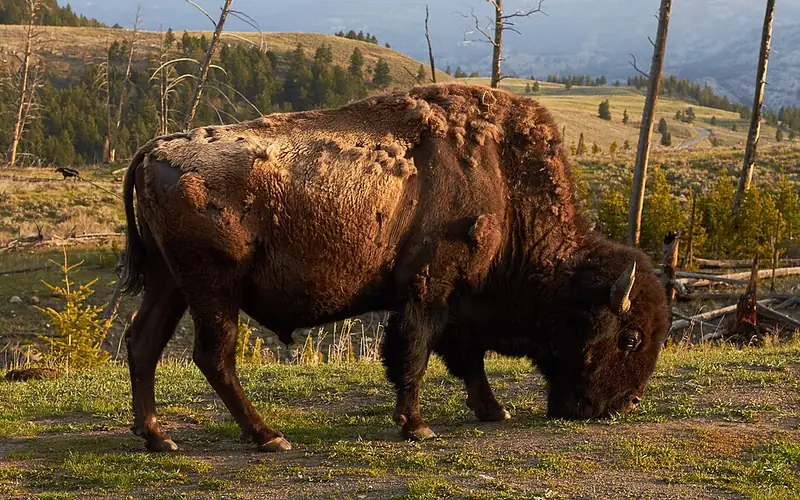
 American bison
Bison bison
The biggest land animal in North America, a shaggy grazer of the plains you can watch cross the road in Yellowstone.
-
 Mammal We saw it
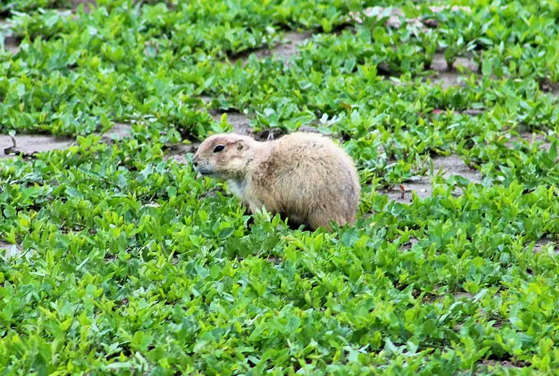
 Black-tailed prairie dog
Cynomys ludovicianus
A burrowing ground squirrel, not a dog. Its towns along Theodore Roosevelt's scenic loop mow the grass short and pull bison and pronghorn in to graze.
-
 Mammal We saw it
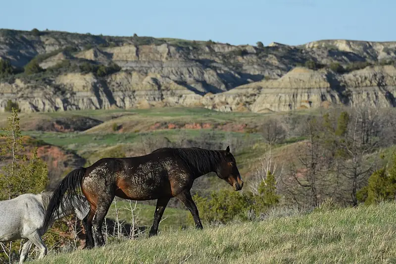
 Feral horse
Equus ferus caballus
Ranch horses turned loose on the open range and never gathered back. Their descendants live in Theodore Roosevelt's South Unit as feral livestock.
-
 Mammal
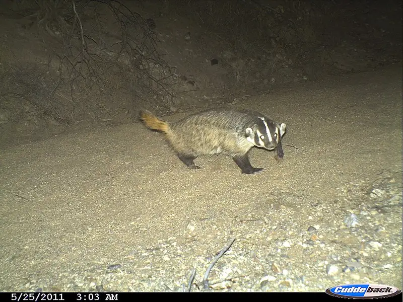
 American badger
Taxidea taxus
A short, wide-bodied digger with a white-striped face, common on the grasslands of Yellowstone and Badlands, that can vanish underground in minutes.
-
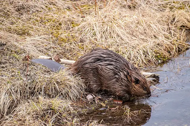 Mammal
 American beaver
Castor canadensis
North America's largest rodent, a keystone species whose dams reshape whole streams at Yellowstone, Glacier, and ten other parks along the route.
-
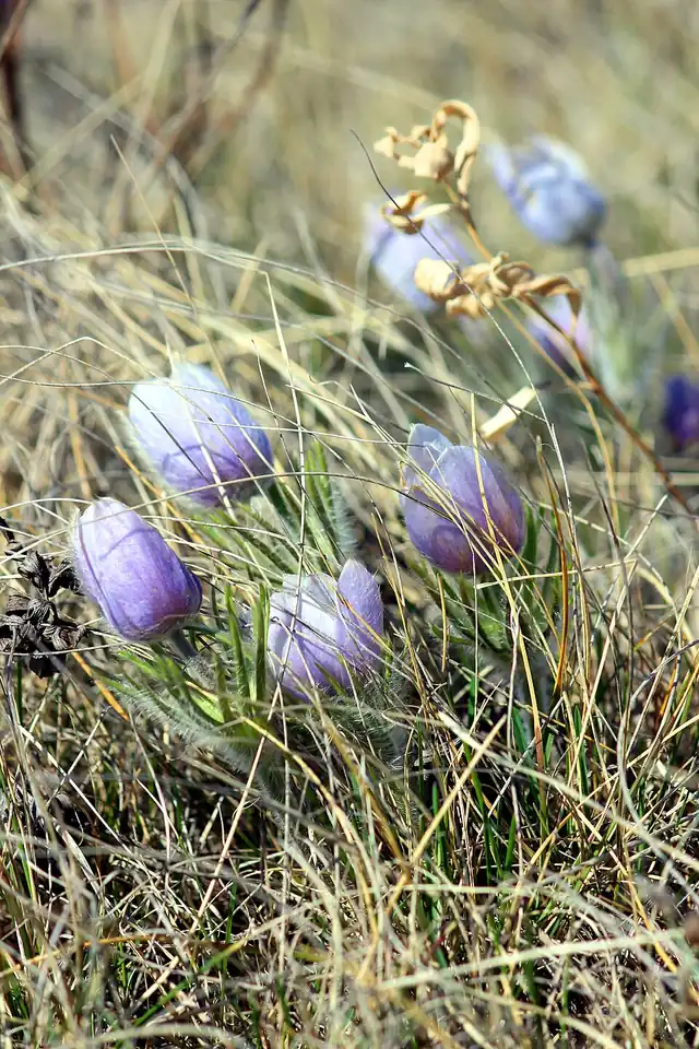 Plant
Plant American pasqueflower
Pulsatilla patens ssp. multifida
A furry, purple-blue prairie flower that beats the grass out of the ground each spring, blooming before almost anything else is green.
III
History
Who shaped this place
Indigenous nations
- Mandan (Nueta) — The Little Missouri River basin lay inside traditional Mandan bison hunting grounds. The badlands slopes were the technique: NPS says the steep terrain let hunters take bison without firing a shot, driving the herd over a drop-off.
- Hidatsa (Nuxbaaga) — NPS calls the Mandan and Hidatsa the most significant peoples of the badlands in historic times, and records that their traditional bison hunting grounds included the Little Missouri River basin. The park's own archaeology runs from Archaic spear points of Knife River flint, dated 5,500 BCE to 500 CE, to a Late Prehistoric bison processing camp.
- Arikara (Sahnish) — Arikara people reached this country in stages up the Missouri, arriving at the river that took their name, the Arickara River of 1723, and the Grand River today, where MHA calls them the Sahnish. The fourth smallpox outbreak struck in 1856, in the Star Village at Beaver Creek, and in 1862 the Sahnish moved up to join the Mandan and Hidatsa at Like-A-Fishhook.
- MHA Nation (Three Affiliated Tribes) — The Mandan, Hidatsa and Arikara began governing themselves as one nation on May 15, 1936. The Nation's own history records that the 1851 Fort Laramie Treaty recognized more than 12 million acres of their land, cut to under 3 million by later policy, and that building the Garrison Dam flooded and dismantled Elbowoods, their main community. Congress appropriated $7.5 million in 1949.
- Lakota — In 1876 General Alfred Terry and George Custer rode out of Fort Lincoln into these badlands. Terry camped three miles south of today's Medora on May 29, and Custer wrote that marching fifty miles that day they forded the crooked Little Missouri River thirty-four times. Rain, sleet and snow held the command near Square Butte from June 1 until June 3.
- Apsáalooke (Crow) — West of these badlands, NPS puts the eastern edge of Crow territory, and contrasts it with the peoples that came into western North Dakota in the early 19th century mainly for hunting and trading, often at Fort Union Trading Post: Blackfeet, Gros Ventre, Chippewa, Cree, Sioux and Rocky Boy, none of whom sought out the badlands the way the Mandan, Hidatsa and Crow did.
Advocates
- William "Bill" Lemke↗ — U.S. Representative (R-ND), 1940s campaign
The Nonpartisan League agrarian populist led the five-year campaign that produced the 1947 act creating Theodore Roosevelt National Memorial Park. It was his last major effort. He died in 1950.
- Theodore Roosevelt — Rancher 1883 to 1887, posthumous namesake
Roosevelt ranched in the badlands at the Maltese Cross and Elkhorn ranches after the deaths of his mother and first wife on the same day in 1884. His Dakota memoirs put the badlands in front of a national readership. He later said he would not have become president without his Dakota years. He arrived on land already home to the Mandan, Hidatsa, and Arikara.
- Quentin Burdick — U.S. Senator (D-ND), 1970s
Carried the 1978 redesignation to national park and the addition of the Theodore Roosevelt Wilderness.
Detractors
- Cattle ranchers, McKenzie and Billings counties — 1940s
Resisted federal acquisition of grazing land during the 1940s campaign to establish the park.
- Coal and oil interests — 1970s to present
Have lobbied for boundary reductions and against wilderness expansion since the 1970s. The Bakken oil boom around 2008 to 2014 brought gas-flare light into the park's night sky.
Timeline
Roosevelt arrives in the Dakota Badlands
Theodore Roosevelt came to Medora in 1883 and bought a stake in the Maltese Cross Ranch, then built the Elkhorn Ranch in 1884. He arrived on land that was already home to the Mandan (Nueta), Hidatsa (Nuxbaaga), and Arikara (Sahnish), allied today as the MHA Nation. He ranched here through 1887. He did not discover the badlands.
Theodore Roosevelt National Memorial Park established
President Harry S. Truman signed the bill on April 25, 1947, creating Theodore Roosevelt National Memorial Park, the only national memorial park ever designated. Representative William Lemke of North Dakota drove the five-year campaign.
North Unit added
Congress added the North Unit, near present-day Watford City, by the Act of June 12, 1948 (Pub. L. 80-602), about 70 miles north of the South Unit.
Bison reintroduced
The park reintroduced bison from Fort Niobrara National Wildlife Refuge in Nebraska in 1956. The herd is now a source for transfers to tribal herds under an NPS surplus-bison program, a living restoration story rather than a closed one.
Redesignated a national park
Congress redesignated the area Theodore Roosevelt National Park on November 10, 1978, under the National Parks and Recreation Act of 1978, and added the 29,920-acre Theodore Roosevelt Wilderness.
Feral horse removal plan suspended
After an NPS draft plan proposed removing the South Unit's roughly 200-head feral horse herd, sustained public and political opposition forced the Park Service to halt the removal plan in April 2024. The herd's future is unresolved.