WY
Grand Teton National Park
A 7,000-foot wall of rock rising straight off Jackson Hole, with flat lake hikes and roadside views that suit short legs.
Established
Coming south on US 89 out of Yellowstone the range arrives all at once, with nothing in front of it, and Little said it looked painted on. We got in on the 25th and spent three days in the valley, all of them on the floor. That is its own story, and it is written up in four days on the valley floor. There is a bingo card for the valley too, twenty-four things to find from the road or a short flat walk. The structured sections below are the homework we did before we drove in: which stops earn the early alarm, which hikes work with short legs, the logistics that catch families out. It held up.
The thing about this range is that it has no foothills on the east side. It lifts about 7,000 feet straight off the valley floor of Jackson Hole, because the Teton fault drops the valley as the peaks rise. A lot of the best looks are near the car: Oxbow Bend and the Snake River Overlook on US 89/191/26, the Mormon Row barns out on Antelope Flats, the drive up Signal Mountain. The hikes we picked for Big and Little were the flat lake loops, String Lake and Taggart Lake, plus Hidden Falls, which we walked to around the lake and came back from on the Jenny Lake boat shuttle. A one-way ticket takes about two miles of flat lakeshore off the return. The valley was seasonal hunting and gathering ground for the Eastern Shoshone, Shoshone-Bannock, Crow (Apsáalooke), Blackfeet, Gros Ventre, Cheyenne, Lakota, and Nez Perce (Niimiipuu) for thousands of years, as the NPS records; Jenny Lake itself carries the name of a Shoshone woman, Jenny Leigh, who assisted the 1872 Hayden Survey through here.
Two things shape the whole trip. The first is bears. Grizzlies are present everywhere, including Cascade Canyon and the highway corridors, so bear spray and noise are part of the routine; Grizzly 399 raised cubs in view of the highway here until a vehicle struck her in October 2024. The second is timing. There is no entry reservation, but parking is the real bottleneck and the Jenny Lake lots fill by 8 a.m. in summer. Ours was full at eight thirty. We also watched the Moose-Wilson Road reconstruction, which runs through 2026 with delays up to 45 minutes and intermittent Death Canyon Road closures, and routed north toward Jenny Lake and Colter Bay instead.
The food and the easy add-ons were simple: the Pioneer Grill counter inside Jackson Lake Lodge and the deck at Dornans by the Moose bridge, a Junior Ranger booklet from the Craig Thomas Discovery and Visitor Center, and a calm-water Snake River float if you have the day for it. The wall does what every photograph says it does. What the photographs leave out is how much of the sky it takes.
I
Basic info
- Established
- 1950
- Area
- 310,000 acres
- Visitors (2024)
- 3,628,222
- Elevation
- 6,320–13,770 ft
- Designation
- National Park (1929)
- Designation
- Jackson Hole National Monument (1943)
II
Logistics
Before you go
- Getting there
- Grand Teton is in northwestern Wyoming, just south of Yellowstone, and its four road entrances can be hours apart. From Yellowstone, drive south past Grant Village about 20 miles to the John D. Rockefeller, Jr. Memorial Parkway. Check road status first, because several entrances close or limit vehicles from November to May. NPS
- How many days
- Driving through from the park's south boundary to Yellowstone on Highway 26/89/191 takes a little over an hour without stops. The Teton Park Road takes slightly longer. NPS gives no day count, only that more time adds ranger-led walks and talks, hiking trails, and picnic areas. NPS Build a day-by-day plan
- Entrance fee
- Entry costs $35 per private vehicle for 7 days (2026), and you need no vehicle reservation. An America the Beautiful pass covers entry. NPS
- Pets
- Only where a car can go, and within 30 feet of the road: roads, campgrounds, picnic areas, and parking lots, on a 6-foot leash (2026). Trails, the multi-use pathway, beaches, buildings, park waters, and the backcountry are closed to pets. NPS
Seasons
Spring
- Interior roads still closed early. Teton Park Road typically opens to bikes first in early May, then to cars. Bears emerge; elk and pronghorn calve.
- 30s to 60s °F. Low-elevation wildflowers begin late May. Mud season can close gravel access roads.
- A quiet shoulder window if you stay on US 26/89/191, which is open year-round. Watch the NPS road report before counting on the inner park road.
Summer
- Full operation and peak crowds, roughly the first week of July through Labor Day. Parking is the real bottleneck; Jenny Lake lots fill by 8 a.m.
- 70s to 80s °F days, 30s to 40s °F nights. Afternoon thunderstorms build most days and can form over the peaks within 30 minutes.
- Start early, be off ridgelines by noon, and plan around the 2025 to 2026 Moose-Wilson Road construction. Carry bear spray everywhere.
Fall
- The best wildlife window of the year. Bull elk bugle and moose enter the rut. Crowds thin after Labor Day.
- 40s to 60s °F days, freezing nights. Cottonwoods along the Snake River turn gold in late September.
- Cooler, quieter, and the animals are active. Interior roads stay open until the first heavy snow closes the Teton Park Road around November 1.
Winter
- Most interior park roads close. The Teton Park Road is plowed for cross-country skiing, not cars.
- Single digits to 30s °F. Deep snow. US 26/89/191 stays open as the winter corridor between Jackson and Yellowstone.
- A different park: ski and snowshoe at Taggart Lake and the Laurance S. Rockefeller Preserve. The National Elk Refuge runs horse-drawn sleigh rides among the wintering herd, mid-December to early April.
Grand Teton National Park with kids
Grand Teton stacks the headline views close to the road, which suits short legs: Oxbow Bend, the Snake River Overlook, Mormon Row, and the Signal Mountain summit are all near-car stops. The family hikes are the flat lake loops (String Lake, Taggart Lake) and the Jenny Lake boat shuttle to Hidden Falls, which trades two miles of flat lakeshore for a short boat ride. Grizzlies are present everywhere, so bear spray and noise are part of the routine. Parking, not entry, is the constraint; arrive early.
- Junior Ranger booklets (a nominal fee) and the Young Naturalist program run out of the Craig Thomas Discovery and Visitor Center at Moose, plus Colter Bay and Jenny Lake.
- String Lake (about 4 miles, mostly flat) has shallow sandy edges where kids can wade on a warm day; it is the family classic.
- Take the Jenny Lake Boat Shuttle to the west dock: Hidden Falls is then about 0.5 mile and Inspiration Point about 1 mile, instead of the long flat lakeshore walk.
- Mormon Row and Menor's Ferry at Moose are short stops out of the car, history kids can walk through rather than hike.
- Carry bear spray and make noise. Grizzlies use Cascade Canyon and the highway corridors; storms can build over the peaks within 30 minutes, so be off exposed ground by noon.
Accessibility
Several of the best views are at or near the car. Oxbow Bend, the Snake River Overlook, and the Mormon Row barns are roadside or a short level walk. The Signal Mountain summit road is a paved drive-up to the only full-range panorama, though it is closed to trailers and large RVs. The lake-loop trails are mostly natural surface.
- Oxbow Bend and the Snake River Overlook are paved pullouts on US 89/191/26 with the range in view; no walk required.
- Signal Mountain Summit Road is paved to the top but narrow, closed to trailers and large RVs, and closed in winter.
- Menor's Ferry at Moose is a flat, stroller-friendly interpretive walk under half a mile through the historic district.
- String Lake and Taggart Lake trails are natural-surface lake loops; the Jenny Lake boat shuttle is a concessioner fee on top of park entry.
Things you can't miss
Natural places
Jenny Lake↗
A glacial lake at the foot of the Cathedral Group, and the busiest hub in the park. The lake carries the name of Jenny Leigh, a Shoshone woman who assisted the 1872 Hayden Survey through this valley with her husband Beaver Dick Leigh. The Jenny Lake Boat Shuttle crosses to the west dock and cuts roughly two miles of flat lakeshore each way off the walk to Hidden Falls and Inspiration Point. The Jenny Lake Renewal Project rebuilt the trails and visitor area, mostly finished by 2025. Parking fills by 8 a.m. in summer.
The Cathedral Group↗
Grand Teton, Mount Owen, and Teewinot: the three-peak silhouette that is the shape on the park map. NPS puts the Grand at 13,770 ft, the highest point in the range. The range has no foothills on its east side. It rises about 7,000 ft straight off the valley floor of Jackson Hole because the Teton fault drops the valley as the range lifts, which is why the wall looks abrupt.
Oxbow Bend↗
A cut-off meander of the Snake River below Jackson Lake Dam, with Mount Moran (12,605 ft) standing behind it. The slow water holds the reflection at first light, which is why it is one of the two dawn stops in the park. Moose, otter, and white pelicans use the side channel; sandhill cranes and trumpeter swans pass through. It is a roadside pullout on US 89/191/26 near Jackson Lake Junction, no hiking required.
Mormon Row and Antelope Flats↗
A row of Latter-day Saint homesteads settled from the 1890s on the open sagebrush bench of Antelope Flats. The T. A. Moulton barn and John Moulton barn stand against the range, and kids can walk the lane between them, a short stop out of the car. Bison and pronghorn move through the flats at dawn and dusk; the bench was their country long before homesteading and remains pronghorn habitat.
Nearby attractions
National Museum of Wildlife Art↗
The congressionally designated National Museum of Wildlife Art of the United States, on a butte above the National Elk Refuge about three miles north of the Jackson Town Square. It holds work by Carl Rungius and Bob Kuhn and a broad wildlife-art collection, and a short sculpture trail loops the hillside. The indoor galleries make it the weather-day option, and the sculpture trail is kid-walkable.
National Elk Refuge↗
Managed by the U.S. Fish and Wildlife Service, not the NPS, and established in 1912 to hold winter range for the Jackson elk herd. Winter numbers commonly run in the thousands. The refuge runs horse-drawn sleigh rides among the elk, typically mid-December through early April, ticketed at the Jackson Hole and Greater Yellowstone Visitor Center on North Cache Street. In summer the elk are on high range and the refuge road is the way through.
Places to stay
Colter Bay Village↗
Log cabins, tent cabins, a campground, an RV park, a marina, and a visitor center on the east shore of Jackson Lake. The swim beach and boat rentals are at the marina, which makes it the family base on the water. The Colter Bay Visitor Center holds the David T. Vernon collection of Indigenous art, though collection access varies, so verify before promising it. Concessioner lodging books up to 12 months ahead for summer.
Jackson Lake Lodge↗
Built in the 1950s with the Rockefeller-era park; the lobby's 60-foot windows frame the range across Willow Flats, and the bar and lounge view is free to walk in and see. Family rooms and a pool, with Oxbow Bend close by for a dawn drive. Reservations run through the Grand Teton Lodge Company up to 12 months ahead for peak summer.
Viewpoints and camping
Snake River Overlook↗
The paved pullout on US 89/191/26 where Ansel Adams made his 1942 photograph of the Snake River and the range. The river bend Adams framed is now partly screened by cottonwoods that have grown up since, which is itself worth pointing out: the spot is the same, the trees are 80 years older. No walk required.
Signal Mountain Summit Road↗
A paved road climbs to a summit area with a view across Jackson Hole to the full range, plus Jackson Lake and the Snake River oxbows below: the only drive-up panorama of the whole range. Two overlooks sit near the top. The road is narrow, closed to trailers and large RVs, and closed in winter.
Trails worth the time
String Lake Loop↗
The family classic. String Lake is shallow and sun-warmed, with sandy edges where kids can wade on a warm day, and it links Jenny Lake to Leigh Lake. The loop stays close to the water the whole way and runs mostly flat. Parking fills early in summer.
Taggart Lake Trail↗
A good first real hike for kids, ending at an alpine lake directly under the range. The trail crosses a 1985 fire scar, which makes a living lesson in how a sagebrush-and-lodgepole slope grows back. The trailhead is off the Teton Park Road south of Jenny Lake.
Hidden Falls and Inspiration Point↗
From the Jenny Lake west boat dock, Hidden Falls is about half a mile and Inspiration Point about a mile with a short climb. The boat shuttle skips roughly two miles of flat lakeshore each way, which is what makes this realistic with kids. Hidden Falls drops about 100 ft in Cascade Canyon; Inspiration Point opens the view back over the lake. The shuttle is a concessioner fee on top of park entry.
Common questions
- When should we go with kids?
- July through early September is full operation but also peak crowds and afternoon storms. Late September into October is the cooler, quieter window with the best wildlife of the year (bugling elk, the moose rut, gold cottonwoods). Most interior roads close around November 1 for winter, so spring and fall trips lean on US 26/89/191, which stays open year-round.
- Do we need a timed-entry reservation?
- No. Grand Teton has no general timed-entry reservation system. Parking is the real bottleneck instead: the Jenny Lake lots fill by 8 a.m. in summer, so arrive early or shift to roadside stops like Oxbow Bend and Mormon Row at dawn.
- What about the Moose-Wilson Road construction?
- The Moose-Wilson Road corridor is under reconstruction through 2026, with delays of up to 45 minutes between Moose and the Laurance S. Rockefeller Preserve and intermittent Death Canyon Road closures in summer. Check the NPS road report before counting on Phelps Lake or the preserve, and plan to route north toward Jenny Lake and Colter Bay instead.
- Are there grizzly bears?
- Yes, and they are present everywhere in the park, including Cascade Canyon and the highway corridors. Carry bear spray, keep it accessible, make noise on the trail, and never leave food in reach. Grizzly 399, the most famous bear in North America, raised cubs in view of the highway here until a vehicle struck and killed her in October 2024.
- Where do we stay or camp?
- In-park lodges (Jackson Lake Lodge, Jenny Lake Lodge, Colter Bay Village, Signal Mountain Lodge) are concessioner-run and book up to 12 months ahead for summer. Campgrounds at Colter Bay, Gros Ventre, Jenny Lake, and Signal Mountain are reservable on Recreation.gov; Jenny Lake is tent-only and the most competitive. The town of Jackson, south of the park, holds the rest.
- Why does a national-park lake have a dam?
- Jackson Lake is a natural lake raised by a dam. The Reclamation Service finished a log-crib dam at the lake outlet in 1907; it failed in 1910, and the replacement went up through the winter of 1910-11 and was completed in 1916, raising the lake 39 ft. It was rebuilt for earthquake safety between 1987 and 1989. It stores Snake River water for Idaho irrigation, which predates the modern park boundary. Mount Moran stands directly behind the dam, so the overlook makes the geology-and-engineering point in one frame.
- Why is it called Grand Teton National Park?
- The park is named for Grand Teton, the peak that towers over the rest of the range. French fur trappers called the range Les Trois Tetons, meaning the three breasts. In 1811 Wilson Price Hunt called the peaks the Pilot Knobs, because he used them to find his way across Union Pass.
Wild things at Grand Teton National Park
See all 66 →-
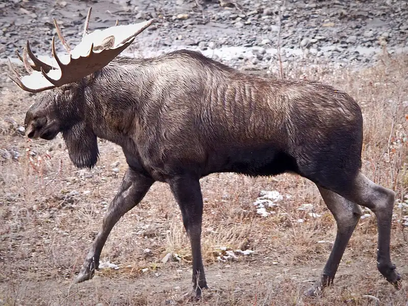 Mammal We saw it
 Moose
Alces alces
The largest deer in the world, a long-legged giant you might see wading in ponds at Grand Teton, Isle Royale, Denali, or Rocky Mountain.
-
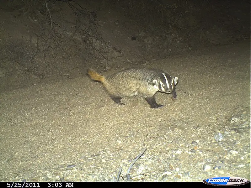 Mammal
 American badger
Taxidea taxus
A short, wide-bodied digger with a white-striped face, common on the grasslands of Yellowstone and Badlands, that can vanish underground in minutes.
-
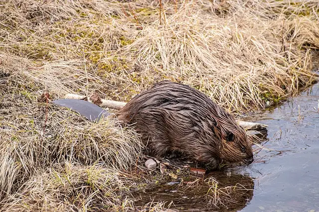 Mammal
 American beaver
Castor canadensis
North America's largest rodent, a keystone species whose dams reshape whole streams at Yellowstone, Glacier, and ten other parks along the route.
-
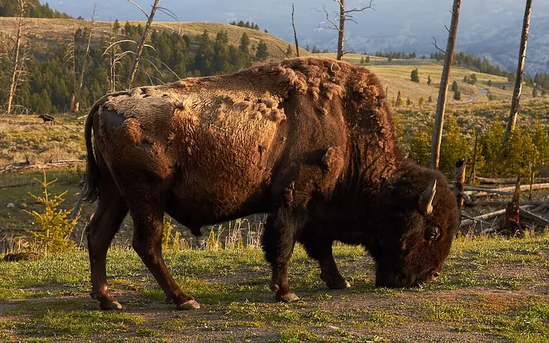 Mammal
 American bison
Bison bison
The biggest land animal in North America, a shaggy grazer of the plains you can watch cross the road in Yellowstone.
-
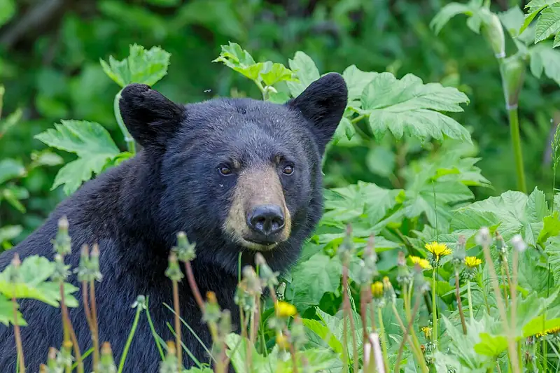 Mammal
 American black bear
Ursus americanus
The bear you're most likely to meet east of the Rockies, a strong tree-climber that eats mostly plants and comes in black, brown, or cinnamon.
-
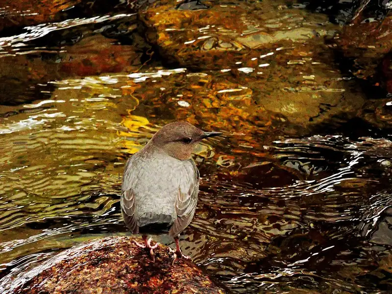 Bird
Bird American dipper
Cinclus mexicanus
A stream-gray songbird that walks along the bottom of cold mountain creeks to hunt, the only songbird in North America that does.
III
History
Who shaped this place
Indigenous nations
- Eastern Shoshone — The Eastern Shoshone Tribe's own history puts its people in this country more than 12,000 years ago and calls the Shoshone the first tribe in the area to have horses. Chief Washakie chose the Wind River Basin for the tribe's reservation when the transcontinental railroad forced the government to make a new treaty.
- Shoshone-Bannock Tribes — The Shoshone-Bannock Tribes hold the Fort Hall Reservation in southeastern Idaho, set aside by executive order in 1867 and affirmed by the Fort Bridger Treaty a year later.
- Crow Tribe (Apsáalooke) — The Crow are among the peoples NPS says were harvesting the valley's seasonal riches when Europeans arrived, and the park says these people camped near rivers and lakes, mostly in the northern part of what is now Grand Teton National Park.
- Blackfeet Nation — The Blackfoot are among the peoples NPS says were harvesting the valley's seasonal riches when Europeans arrived, and the park says they camped near rivers and lakes and left for milder country with the coming of winter.
- Gros Ventre — The Gros Ventre are among the peoples NPS says were harvesting the valley's seasonal resources when Europeans arrived.
- Nez Perce (Niimiipuu) — The Nez Perce are among the peoples NPS says were harvesting the Grand Teton valley's seasonal riches when Europeans arrived, and the park says these people camped near rivers and lakes, mostly in the northern part of what is now the park.
Advocates
- John D. Rockefeller Jr.↗ — Funder of the Jackson Hole acquisition
Visited the valley with Yellowstone Superintendent Horace Albright in 1926 and concluded the whole valley needed protecting. He spent over $1.5 million buying Jackson Hole ranchland in secret through the Snake River Land Company, then in 1942 issued an ultimatum: accept the donation or he would sell. The pressure forced the 1943 monument.
- Horace M. Albright↗ — Yellowstone Superintendent, later NPS director
Brought Rockefeller to Jackson Hole in 1926 and argued for decades that the valley floor, not just the range, belonged in the park.
- Olaus and Mardy Murie↗ — Conservation biologists, based at Moose
From their cabins at the Murie Ranch they made the ecological case for protecting the whole valley and for the wilderness idea. Mardy Murie was later called the godmother of American conservation.
- Struthers Burt — Bar BC dude rancher
One of the few local voices in favor of protecting the valley, against most of his ranching neighbors.
Detractors
- Wyoming congressional delegation — 1930s to 1940s
Wyoming's senators and representatives blocked acceptance of Rockefeller's donation for over a decade and introduced bills in the 1940s to abolish the Jackson Hole monument. The one that passed both houses died by Roosevelt's pocket veto; three later attempts never left committee.
- Jackson Hole ranchers — 1930 onward
Many felt deceived once the Snake River Land Company's Rockefeller backing was revealed in 1930, having sold at low prices believing the buyer was a local rancher. The Wyoming Stock Growers Association lost summer grazing.
- 1943 armed cattle protest — Wallace Beery and Clifford Hansen
After FDR's monument proclamation, actor Wallace Beery and future Wyoming Senator Clifford Hansen led an armed cattle drive across the monument without a permit, in symbolic protest. No shots were fired and no charges were filed.
Timeline
Teton Forest Reserve set aside
President Grover Cleveland set aside the Teton Forest Reserve, later Teton National Forest. The range was federally protected as forest for decades before any park existed. The valley had been seasonal hunting and gathering ground for the Eastern Shoshone, Bannock, Crow, Blackfeet, Gros Ventre, Cheyenne, Lakota, and Nez Perce for thousands of years before that.
Grand Teton National Park created
President Calvin Coolidge signed the Act of February 26, 1929, creating a roughly 96,000-acre park covering the Teton Range and the glacial lakes at its base. The valley floor of Jackson Hole was left out under ranching opposition.
Jackson Hole National Monument proclaimed
After Congress refused John D. Rockefeller Jr.'s land donation for over a decade, President Franklin D. Roosevelt used the Antiquities Act on March 15, 1943 to protect about 221,000 acres as Jackson Hole National Monument. The proclamation set off an armed cattle drive in protest and a bill to abolish the monument that passed both houses; Roosevelt killed it with a pocket veto, and three later attempts never left committee.
Merged into the modern park
The Act of September 14, 1950 merged the 1929 park, the 1943 monument, and Rockefeller's roughly 35,000-acre donation into the modern 310,000-acre park. The compromise wrote in a clause barring any further national park or monument in Wyoming without an act of Congress. Both halves are still law (54 U.S.C. 104907 and 320301(d)), and Wyoming is the only state named inside the Antiquities Act itself.
Laurance S. Rockefeller Preserve donated
John D. Rockefeller Jr. bought the JY Ranch in 1932 intending to give it to the park, then kept it as a family retreat instead. His son Laurance transferred the last 1,106 acres in November 2007, after thirty buildings, roads and utilities were removed between 2004 and 2007. Parking is limited by design, and NPS says it is often full from before 8 a.m. to 5 p.m.
3,628,222 visitors, second-busiest year
Grand Teton drew 3,628,222 visitors in 2024, its second-busiest year on record. Visitor spending reached about $808 million, with the biggest gains in the April, May, and October shoulder months.