AZ
Saguaro National Park
Saguaro forests in two districts bracketing Tucson, the bahidaj harvest grounds of the Tohono O'odham, the Desert People.
Established
The park comes in two pieces, the Rincon Mountain District east of Tucson and the Tucson Mountain District west of it, about 30 miles and an hour apart through the city. The first planning question is which one, or whether the days allow both. Each district has a scenic drive that tours the saguaro forest from the car (the paved 8-mile Cactus Forest Drive in the east, the 6 miles of graded dirt on the Bajada Loop in the west), so even a hot afternoon has a version that works. The land in both districts is the homeland of the Tohono O’odham, the Desert People, whose name the Nation re-established in its own language. The saguaro fruit, bahidaj, that follows the spring bloom is still harvested in the park each June and July, a current practice the NPS documents, not a closed chapter. The petroglyphs at Signal Hill were carved by the Hohokam, the ancestors of today’s O’odham.
Two things run backward here from the parks we’ve planned so far. The first is the calendar. Saguaro’s peak season is November through March, the cool desert window, while summer climbs to 105 or 110 °F and a mid-day hike becomes a safety problem rather than a hot one. That puts the comfortable months out of phase with most school breaks, so we plan dates around the heat first and everything else second. The second is water. There’s none at most trailheads and no food in either district, only the two visitor centers for a refill, so the jugs and the lunch get handled in Tucson before we turn off the highway. Cell service is fine; we’ll have the suburbs at our back the whole time.
From our visit
We were in the park on Sunday, November 8 and Friday, November 13, 2026, the west district first and the east district a week later.
- The temperature was the first thing. We left Flagstaff after a night at 36 °F and stepped out of the van in Tucson to over 80 °F and full sun. The Desert Discovery Trail is half a mile of pavement, and it was a harder half mile than the number suggests. We walked it in the middle of the day and drank more water than we had planned for. The cool season here is not the same thing as a cool day.
- Signal Hill, late in the afternoon. The trail climbs a wash that was dry except for wet spots from rain a few days earlier. From the bottom we could already see petroglyphs on the hillside, and the spiral was the one a ranger had described to us as the journey to find center. Up the stairs there were more than we could take in at one look, animals and scenes and shapes we could not name. He also told us a sharp stone throws a shadow across the spiral at the solstices. NPS does not publish that for this hill, and the Hohokam sun-watching site archaeologists have written up in detail is at Picture Rocks, a few miles west. We came down as the sun dropped behind the ridge and the air cooled all at once.
- The Arizona-Sonora Desert Museum on Monday. The touch pool, where cownose rays come to a hand held still in the water. The Packrat Playhouse, which Big and Little vanished into for longer than we expected. And the reptile hall, where Big, who has decided he wants to be a herpetologist, read every placard and then went back to the first one.
- Biosphere 2. Self-guided through the library and the lungs, the two chambers that let a sealed building breathe. The audacity of it is the part that stayed with us: a group of people sealing themselves inside a structure on Biosphere 1 to see whether they could keep the air right. We read about the second crew afterward, and about Steve Bannon, who was an investment banker hired by the funder, Ed Bass, and acting CEO from April 1994. Not a founder, not a crew member, whatever the retellings say.
- The Freeman Homestead walk on Friday. A ranger at the Rincon Mountain Visitor Center was setting up the walk when we walked in, and he turned out to be the person who had interviewed the living Freeman family and brought photographs from when the house still stood. The house is gone. The well is down by the wash. He told us they lived there only as long as the patent required, leased the grazing, and hosted parties, and that the 500-odd acres sold in 1952 for $16,000, which he said was the most ever paid for a homestead. We have not found that price in a public record, so it stays where he put it: something the ranger told us.
- The swearing-in. The same ranger swore in Big and Little for their Junior Ranger badges, then picked up the visitor center loudspeaker and announced it to the room, welcoming them to the park and naming their goal of visiting all 64.
We leave Tucson on Sunday for Chiricahua.
I
Basic info
- Established
- 1994
- Area
- 91,716 acres
- Visitors (2024)
- 946,058
- Elevation
- 2,180–8,664 ft
- Designation
- National Monument (1933, Rincon Mountain District)
- Designation
- National Park (1994)
II
Logistics
Before you go
- Getting there
- The park has two districts on opposite sides of Tucson, Arizona. Type the address, not the park name, into your map app: 3693 S. Old Spanish Trail for the east district, and 2700 N. Kinney Road for the west district. NPS
- How many days
- The park has two sides. The east side has an 8-mile paved loop drive and the west side a 5-mile gravel loop, and they differ in plants, trails, and elevation. NPS doesn't break a visit down by days. NPS
- Entrance fee
- Entry costs $25 per private vehicle for 7 days and covers both districts (2026). An America the Beautiful pass covers entry. NPS
- Pets
- Leashed pets (6 feet) may use only a few routes: Mica View road, the Desert Ecology Trail, and Cactus Forest Loop Road in the east, and Bajada Loop Drive, the Desert Discovery Trail, and Golden Gate Road in the west (2026). All other trails are closed to pets. NPS
Seasons
Spring
- Warming fast. Wildflowers run mid-March on a wet winter; the saguaro bloom, Arizona's state flower, opens late April into early June.
- 80s to 95 °F by May. White saguaro flowers open at night and close by mid-morning, so the bloom is a sunrise errand.
- Good for the bloom and for early-morning walks. By May the family plans to be off exposed trails before the heat arrives.
Summer
- The off-season here, and the dangerous one. Visitation drops more than 70 percent. The North American monsoon runs June 15 to September 30, and July and early August bring Tucson's most frequent lightning of the year.
- 100 to 110 °F days, 75 to 85 °F nights. Saguaro fruit (bahidaj) ripens late June into July, when the Tohono O'odham harvest it.
- Hike before 8 a.m. or skip the trails entirely. The family treats mid-day exposure as a safety line, not a comfort one.
Fall
- Cooling back into the comfortable range. The second-best window after the spring heat breaks.
- 80s to 90s °F early, dropping into the 70s by late October.
- A quieter approach to peak season. Mornings are walkable again; afternoons still want shade and water.
Winter
- Peak season, the inverse of most national parks. Both districts stay open; the desert is green after winter rain.
- 60s to 70s °F days, 40s nights.
- The family window. Cool enough to walk all day, and the saguaros and palo verdes look greenest. Book the gateway campgrounds ahead.
Saguaro National Park with kids
Saguaro is two districts bracketing Tucson, about 30 miles and an hour apart through the city, so the planning question is east, west, or both. The headline features sit close to the road in both: the Cactus Forest Drive in the east and the Bajada Loop Drive in the west each work as a slow saguaro tour from the car with short walks bolted on. There is no campground and no food inside the park, and most trailheads have no water. The cool season runs November through March, which is the opposite of when school breaks line up, so the family plans dates around the heat first.
- Saguaro runs one Junior Ranger booklet, free at either visitor center or as a download; a kid completes it, gets sworn in, and receives a badge and certificate.
- The Desert Discovery Trail (0.5 mi paved loop at the west visitor center) is the one stroller-friendly walk; everything else wants a carrier.
- Signal Hill (0.3 mi) and Valley View Overlook (0.8 mi) are the short west-district walks that small legs can finish: petroglyphs at the top of one, the Avra Valley spread out below the other.
- Jumping cholla segments break off and stick to legs and ankles on contact. Carry a wide-toothed comb to lift them off; do not grab them.
- Don't touch the saguaros. The spines carry bacteria and the cactus walls bruise easily.
- No food in the park and water only at the two visitor centers. Pack lunch and fill jugs in Tucson before driving in.
Accessibility
Both scenic drives put the saguaro forest at car-door distance, which carries the day for anyone who can't manage rough trail. The Cactus Forest Drive in the east is 8 paved miles; the Bajada Loop in the west is 6 miles of graded dirt, slow but passable for most cars. The one fully accessible walk is the paved Desert Discovery Trail at the west visitor center. Most named trails beyond it are unimproved desert tread.
- Desert Discovery Trail: 0.5-mile paved loop at the Red Hills Visitor Center (west), level, with interpretive panels and shade ramadas.
- Cactus Forest Drive (east): 8 paved miles, a saguaro tour entirely from the car with several pull-out viewpoints.
- Bajada Loop Drive (west): 6 miles of graded dirt, passable for most cars; the Signal Hill and Valley View trailheads branch off it.
- Both visitor centers (Red Hills in the west, Rincon Mountain in the east) are accessible and the only reliable water in the park.
Things you can't miss
Natural places
Cactus Forest Drive↗
The headline of the east district: an 8-mile paved one-way loop through some of the densest saguaro stands in the park, drivable in 45 minutes if you only stop at the pull-outs or closer to two hours with a couple of short walks. It is open 7 a.m. to sunset and open to bicycles, one of the few places in either district a family can ride together on pavement. Distinct from the Cactus Forest Loop Trail, which is unpaved and shares the name.
Signal Hill Petroglyphs↗
A 0.3-mile rock walk to a hilltop with one of the largest petroglyph concentrations in the park, more than 200 images carved into desert-varnished boulders by the Hohokam, who lived in southern Arizona from about A.D. 300 to 1450. The images here were made roughly 550 to 1,550 years ago. The O'odham descend from them. Short enough for tired legs, and the carvings are waiting at the top. They are fragile, and the Park Service asks visitors to look, not touch or chalk.
Bajada Loop Drive↗
The west district's answer to the Cactus Forest Drive: a 6-mile unpaved scenic loop through the densest saguaro stands in the park. Graded dirt, passable for most cars, slow going. The Signal Hill and Valley View Overlook trailheads both branch off it, so the road doubles as the spine of a west-district morning before the heat builds.
Saguaro bloom↗
Not a place but a window. The white waxy flowers, Arizona's state flower, open at night and close by mid-morning; the bloom runs late April into early June, and the fruit (bahidaj) the Tohono O'odham harvest ripens late June into July. A saguaro does not flower until roughly 35 years old and does not grow arms until 60 to 75, and up to 100 on drier ground, per NPS, so a blooming arm is older than most of the people looking up at it. Best caught at sunrise in either district during the spring window.
Mica View↗
A picnic area off the Cactus Forest Drive with short, flat walks among some of the largest saguaros in the east district. The Mica View Trail runs a roughly 2-mile flat loop. A shade-free morning stop for a family that wants the saguaro forest without a climb, with the Rincons standing up behind the cactus.
Cholla and ocotillo flats↗
The saguaro does not stand alone. It shares the ground with palo verde, mesquite, prickly pear, ocotillo, brittlebush, and cholla, the full Sonoran community, per NPS. One member earns a warning: jumping (teddy-bear) cholla segments break off and stick to legs and ankles on contact, so the family plans to carry a wide-toothed comb to lift them off rather than grab them. The flats glow when the low sun backlights the spines.
Nearby attractions
Arizona-Sonora Desert Museum↗
A combined museum, botanical garden, and zoo on the west edge of the Tucson Mountains near Gates Pass, interpreting the Sonoran Desert that surrounds the park. The base dossier calls it the single best supplemental stop for kids, who will learn more here than from any visitor center. It pairs naturally with a Bajada Loop morning. Separate admission; not covered by the park entry fee.
Sabino Canyon↗
A canyon with a seasonal creek in the Santa Catalina Mountains northeast of Tucson, on Coronado National Forest land rather than in the park. The most-used swimming-and-hiking spot in the Tucson area, with a tram up the canyon road. Worth flagging for families who want water on a desert trip, which Saguaro itself does not reliably offer. Separate fee, separate shuttle.
Biosphere 2↗
A 3.14-acre sealed structure of glass and steel north of Tucson, built to test whether people could live inside a closed ecosystem, with its own farming, wetlands, and an ocean. The University of Arizona has run it since 2011. Self-guided tours, plus the Lung Tour down to the two variable-volume chambers that let the building breathe as the air inside warms and cools. It is a research facility rather than a park, so the day is a tour, not a hike.
Places to stay
Catalina State Park↗
A state park at the foot of the Santa Catalina Mountains north of Tucson, with a developed campground, roughly 30 to 40 minutes from either Saguaro district through the city. The better-equipped of the two family camping bases. Book ahead in winter, which is the park's peak season here the way it is at Saguaro.
Gilbert Ray Campground↗
A Pima County campground inside Tucson Mountain Park, directly adjacent to the west district and a short drive from the Desert Museum and Gates Pass. The closest tent and small-RV camping to the Tucson Mountain District. First-come, first-served, with fees collected on site, so it is the less certain of the two but the nearer one.
Viewpoints and camping
Valley View Overlook↗
A 0.8-mile round-trip with about 100 feet of gain to a wide-open view over the Avra Valley, off the Bajada Loop Drive. Short and mostly gentle, with the valley opening up at the turnaround, which makes it one of the cleaner west-district walks for small legs.
Gates Pass↗
A pass over the Tucson Mountains on the road between Tucson and the west district, in Pima County's Tucson Mountain Park rather than the park. The base dossier names it the best free sunset overlook in the area. Parking is limited and fills before sunset on weekends, so the plan is to arrive early and wait for the light.
Wasson Peak↗
At 4,687 feet, the highest point in the Tucson Mountains, reached by a 7-mile round-trip on the King Canyon or Hugh Norris trails with full sun and no water on the route. The summit view runs across the whole west-district saguaro country. An older-kids, early-start, cool-season hike, listed here for the view at the top with its trail facts attached so a family can judge the climb.
Trails worth the time
Cactus Forest Loop Trail↗
A flat 5.4-mile loop through the east-district cactus forest that allows bikes, per the base dossier. A family can ride a few miles in and turn around rather than commit to the whole loop. Keep it separate from the paved 8-mile Cactus Forest Drive: this is the unpaved trail of a similar name, the riding-and-walking version of the same forest.
Freeman Homestead Trail↗
A roughly one-mile loop in the east district past what is left of a 1930s homestead: the foundation, a wash, and a grove of large saguaros. NPS keeps numbered signs along it, and notes that great horned owls are often in the cliff above the wash. The house is gone; the well sits down by the wash. A ranger-led walk here is the reason to time the visit to a program rather than walk it alone.
Our pick for food and drink
El Charro Café (Tucson)↗
The practical answer to where a family eats between the two districts: a long-running Tucson Sonoran-Mexican spot downtown, roughly 20 to 30 minutes from either side of the park. Tucson is a UNESCO City of Gastronomy and Sonoran food is the regional anchor, so the gateway city, not the park, is where the meals happen. Family-friendly, walk-in.
Common questions
- East district or west district?
- West (Tucson Mountain District) for the densest saguaro forest, the short kid walks, and the run of the Bajada Loop Drive, the Desert Museum, and Gates Pass in one day. East (Rincon Mountain District) for the 8-mile paved Cactus Forest Drive, the longer trails, and the road up into the sky-island wilderness. They sit about 30 miles apart, an hour through Tucson; the family plans to do both if the days allow.
- When should we go with kids?
- November through March. Saguaro inverts the usual park calendar: winter is peak season, with 60s-to-70s days, while summer runs 100 to 110 °F and visitation drops more than 70 percent. The saguaro bloom is late April into early June, a warm but doable shoulder if you walk at sunrise.
- Where do we get food and water?
- In Tucson. There is no food inside either district and no concessioner; water is only at the two visitor centers, and most trailheads have none. Pack lunch and fill the jugs in town before driving in. Cell service is fine in both districts; you are essentially in the suburbs.
- Where do we camp or sleep?
- Not inside the park, except backcountry wilderness sites in the Rincon high country that need a permit and a multi-mile climb. Families camp at Gilbert Ray Campground in Tucson Mountain Park, next to the west district, or at Catalina State Park north of Tucson. Tucson itself has the full range of motels.
- What is the entrance fee?
- $25 per vehicle for a 7-day pass, good for both districts. The $80 America the Beautiful annual pass pays off by the third national park unit in a year.
- What are the real hazards here?
- Heat first. Temperatures of 105 to 115 °F from May into September make mid-day hiking a safety matter; carry water and start early. Jumping cholla segments stick to skin on contact (carry a comb). Rattlesnakes are active March through November. None of it is a reason to skip the park, but the desert does not forgive a hot afternoon with no water.
- Why is it called Saguaro National Park?
- The saguaro cactus is the park's namesake. Every ten years the park counts saguaros across its east and west districts in a Saguaro Census.
- Do we need a reservation to visit Saguaro National Park?
- No timed entry. A 7-day entrance pass, $25 per private vehicle, covers both the Tucson Mountain District (West) and the Rincon Mountain District (East) (2026). Overnight backcountry trips need a permit.
- Whose land is this?
- Saguaro sits on Tohono O'odham land, the desert half of the O'odham world. The Akimel O'odham are the river people to the north, and both descend from the Hohokam who carved the petroglyphs at Signal Hill. The Pascua Yaqui Tribe is federally recognized and based in Tucson, and NPS lists it among the park's traditionally associated tribes, but the Yoeme homeland is the Yaqui River valley in Sonora, and the Tribe describes Old Pascua as an ancestral community in the city rather than this desert. Being associated with a park and being the homeland of it are two different things, and the notes above keep them apart.
Wild things at Saguaro National Park
See all 29 →-
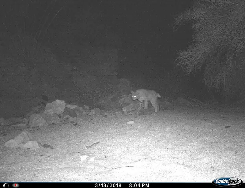 Mammal
Bobcat
Lynx rufus
A small wildcat about twice the size of a house cat, common but rarely seen, that can bring down prey many times its own weight.
-
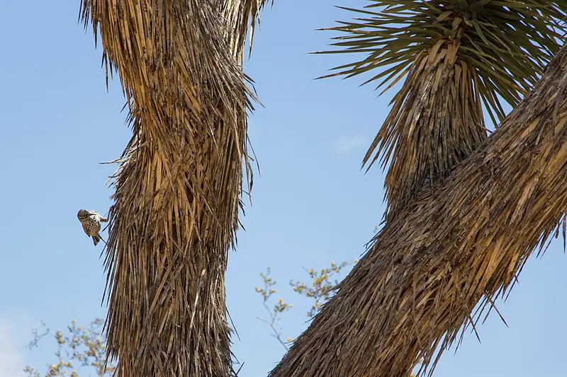 Bird
Cactus wren
Campylorhynchus brunneicapillus
The largest wren in the U.S., which jams a football-shaped nest deep inside a cholla cactus's own thorns for protection.
-
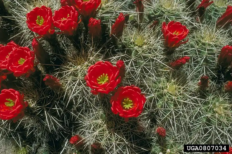 Plant
Claret cup cactus
Echinocereus triglochidiatus
A low, mounding desert cactus that bursts into bright red, cup-shaped flowers each spring on rocky ground across the Southwest.
-
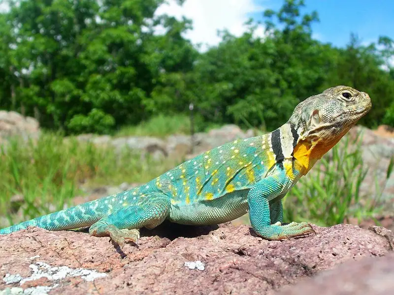 Reptile
Common collared lizard
Crotaphytus collaris
A bright, big-headed lizard with two black neck bands that can sprint on its back legs like a tiny dinosaur across desert rock.
-
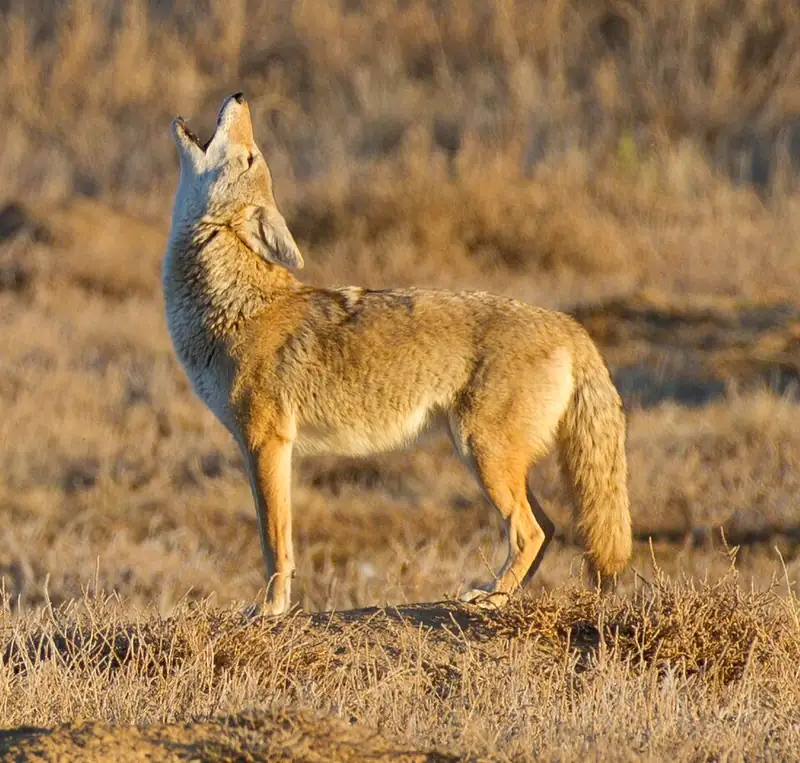 Mammal
Coyote
Canis latrans
The wild dog you're most likely to hear at a national park — a coyote, at home in the desert, the mountains, and the edges of towns.
-
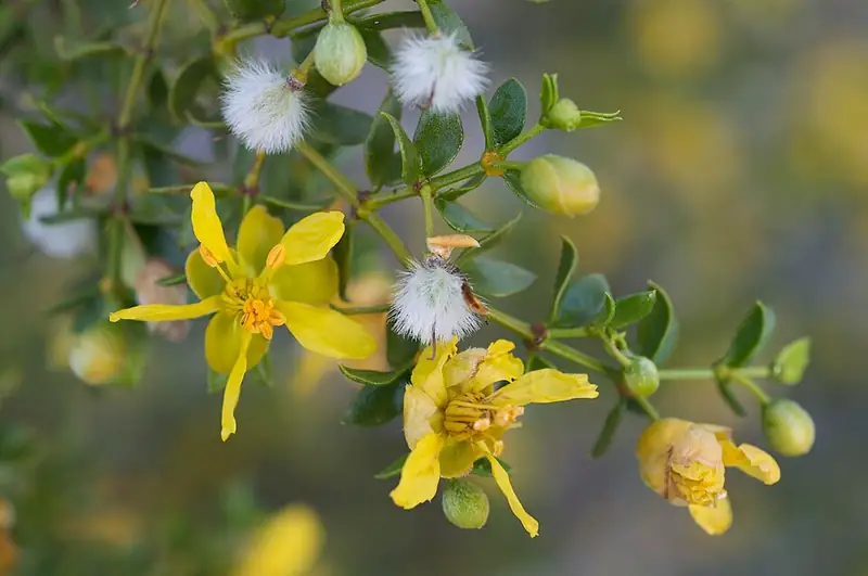 Plant
Creosote bush
Larrea tridentata
The scraggly desert shrub whose leaves make the smell of desert rain, and whose slow-spreading clone rings are among the oldest living things on Earth.
III
History
Who shaped this place
Indigenous nations
- Tohono O'odham Nation — The park sits inside the Papagueria, the O'odham country the Nation's own history page describes running from Sonora north past Phoenix and east to the San Pedro River, halved by the 1853 Gadsden Purchase. O'odham accounts say the land was given to the people by Elder Brother. NPS records the saguaro harvest as a yearly June and July event with social and religious festivities, and O'odham women preparing drinks including saguaro wine. Harvesting saguaro fruit and cholla buds in the park is formalized: the Nation and the park worked together on it from the west district's establishment in 1961, a 2016 rule set the framework, and the assessment and finding were finalized in June 2018.
- Akimel O'odham — NPS gives the Akimel their name from the O'odham word for river, and describes them as the canal builders who used the Santa Cruz River and the summer monsoon to cut acequias and basins for their crops, in contrast to the Tohono, the desert O'odham, who moved between two village locations to follow the water. The four federally recognized O'odham tribes today include the Salt River Pima-Maricopa Indian Community and the Gila River Indian Community. Their tie to this park is ancestry and consultation rather than the bajada itself; the desert O'odham are the ones whose homeland both districts sit on.
Advocates
- Homer L. Shantz — University of Arizona botanist and president
Drove the early advocacy in the 1920s to protect the cactus forest east of Tucson, the scientific case that led to the 1933 monument.
- Frank Harris Hitchcock — Tucson Citizen publisher, former U.S. Postmaster General
Lobbied President Hoover to sign the 1933 proclamation, converting Shantz's scientific case into political reality.
- Stewart L. Udall↗ — Secretary of the Interior, Tucson native
Pushed President Kennedy to add the Tucson Mountain District west of the city as a second unit of the monument in 1961.
- Morris K. Udall & Dennis DeConcini↗ — Arizona congressional sponsors, 1994
Representative Mo Udall (brother of Stewart) and Senator Dennis DeConcini carried Public Law 103-364 (S. 316), which elevated the monument to a national park in 1994.
Detractors
- Tucson developers and ranchers — 1933 and 1961
Tucson developers and ranchers objected to the original Rincon Mountain District boundary in 1933, and Pima County, holding title to the future Tucson Mountain District, had to be persuaded to transfer it in 1961.
- Tucson business groups — 1980s to 1990s
Some Tucson business interests opposed national-park status, fearing federal limits on adjacent development. Urban encroachment on both district boundaries, especially the eastern Rincon edge, remains the ongoing fight.
Timeline
Saguaro National Monument proclaimed
President Herbert Hoover signed Proclamation 2032 on March 1, 1933, creating Saguaro National Monument from the Rincon Mountain District east of Tucson, about 63,360 acres. Tucson Citizen publisher Frank Harris Hitchcock had lobbied Hoover after years of advocacy by University of Arizona botanist Homer L. Shantz.
Tucson Mountain District added
President John F. Kennedy signed Proclamation 3439 on November 15, 1961, adding the Tucson Mountain District west of the city as a second, separate unit of the monument. Interior Secretary Stewart Udall, a Tucson native, pushed for it; Pima County held title to the land and had to be persuaded to transfer it.
Wilderness designated
President Jimmy Carter signed Proclamation 4720 on October 21, 1976, designating 71,400 acres of the monument as wilderness, most of it in the high Rincon backcountry.
Elevated to national park
President Bill Clinton signed Public Law 103-364 (S. 316, the Saguaro National Park Establishment Act of 1994) on October 14, 1994, elevating the combined monument to Saguaro National Park at about 91,438 acres. Representative Morris K. Udall and Senator Dennis DeConcini of Arizona carried the legislation; the act required Pima County and the University of Arizona to transfer further land.
Saguaro-fruit harvest formalized in the park
The Tohono O'odham saguaro-fruit (bahidaj) harvest inside the park was formalized under the NPS 2016 plant-gathering rule (36 CFR 2.6); the environmental assessment and agreement for the harvest were completed in 2017 and 2018. The harvest is a current practice, not a historical one: it occurs yearly in June and July, accompanied by social and religious observance.
946,058 visitors
Visitation has run near or above one million since 2019, with an all-time peak of 1,079,786 in 2021 and 1,010,906 in 2023 (the third-busiest year on record); 2024 came in at about 946,058. Tucson's growth and the post-2020 outdoor surge drove the climb. The cool November-to-March window carries most of it.